


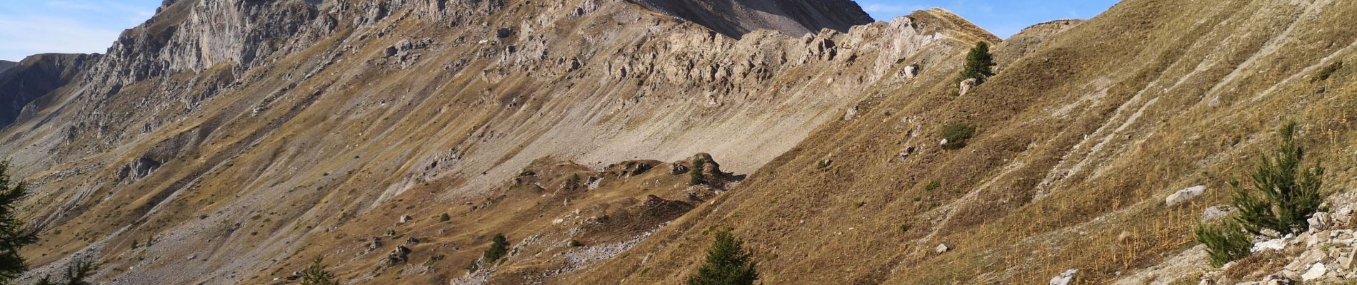
Circuit Col de Chorges/Tête des Parias/La Pousterlle/Col de la Gardette. 27/09/19.

Dervalmarc
User
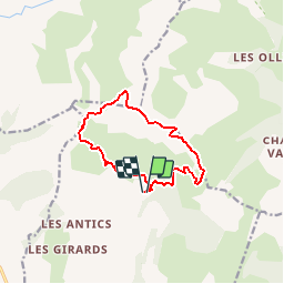

Length
10.9 km

Max alt
2499 m

Uphill gradient
980 m
Km-Effort
24 km

Min alt
1689 m

Downhill gradient
983 m
Boucle
Yes
Creation date :
2019-09-27 08:19:51.084
Updated on :
2019-09-28 14:32:33.293
8h32
Difficulty : Very difficult

FREE GPS app for hiking
 SityTrail
IGN / Geographical institutes
SityTrail Plus
The world is yours!
About
Trail Walking of 10.9 km to be discovered at Provence-Alpes-Côte d'Azur, Hautes-Alpes, Chorges. This trail is proposed by Dervalmarc.
Description
Rando très sportive. Nombreux passages aérien en crêtes.
Descente de la Pousterlle attention au vide.
Passage gazeux.
Photos


Positioning
Country:
France
Region :
Provence-Alpes-Côte d'Azur
Department/Province :
Hautes-Alpes
Municipality :
Chorges
Location:
Unknown
Start:(Dec)
Start:(UTM)
284921 ; 4940303 (32T) N.
Comments