


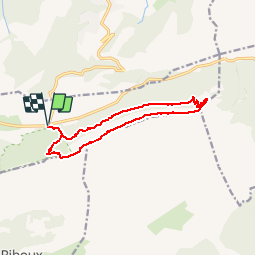

8.4 km | 15.5 km-effort

User


FREE GPS app for hiking
 SityTrail
IGN / Geographical institutes
SityTrail World
The world is yours!
Trail Walking of 12.9 km to be discovered at Provence-Alpes-Côte d'Azur, Var, Plan-d'Aups-Sainte-Baume. This trail is proposed by Gouze13.
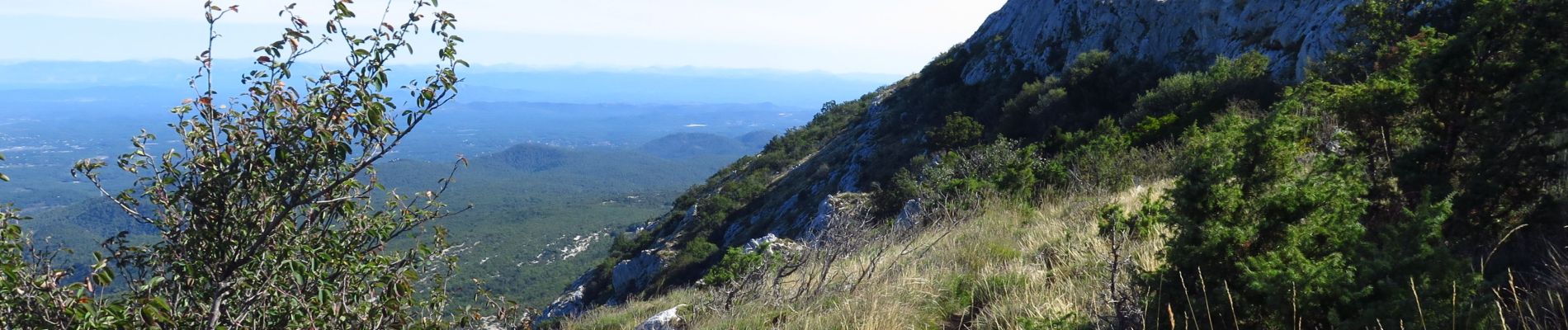
Prudence sur les traces en face nord, non balisées. Lecture du terrain indispensable.


Walking

Walking

Walking

Walking

Walking

Walking

Walking

Walking
On foot