


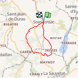
2010SoumensacMarsalou

garigotte
User

Length
9.5 km

Max alt
176 m

Uphill gradient
201 m
Km-Effort
12.2 km

Min alt
64 m

Downhill gradient
205 m
Boucle
Yes
Creation date :
2019-09-30 10:47:33.656
Updated on :
2019-09-30 10:49:27.48
2h37
Difficulty : Medium

FREE GPS app for hiking
 SityTrail
IGN / Geographical institutes
SityTrail Plus
The world is yours!
About
Trail Walking of 9.5 km to be discovered at New Aquitaine, Lot-et-Garonne, Soumensac. This trail is proposed by garigotte.
Description
rando facile et agreable
Positioning
Country:
France
Region :
New Aquitaine
Department/Province :
Lot-et-Garonne
Municipality :
Soumensac
Location:
Unknown
Start:(Dec)
Start:(UTM)
288188 ; 4951978 (31T) N.
Comments