Trail Walking Carolles - Falaises de Carolles  - Photo

Falaises de Carolles

 SyMA
SyMA

User

© OpenStreetMap contributors
Length
Length
4.1 km
Max alt
Max alt
61 m
Uphill gradient
Uphill gradient
96 m
Km-Effort
Km-Effort  
5.4 km
Min alt
Min alt
6 m
Downhill gradient
Downhill gradient
92 m
Boucle
Boucle
Yes
Creation date :
2019-09-30 09:32:11.145
Updated on :
2019-10-02 06:25:45.907

(0 Reviews)

Walking
Walking
1h06
Difficulty : Very easy

Scan this QR Code to open this trail in the SityTrail application

FREE GPS app for hiking

Logo SityTrail SityTrail

IGN / Geographical institutes

Download SityTrail from the App Store Download SityTrail from Google Play

Logo SityTrail SityTrail World

The world is yours!

Download SityTrail from the App Store Download SityTrail from Google Play Download SityTrail on Huawei AppGallery

About

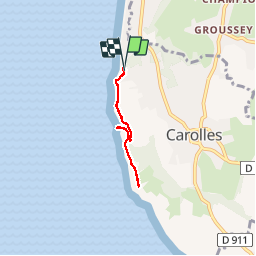
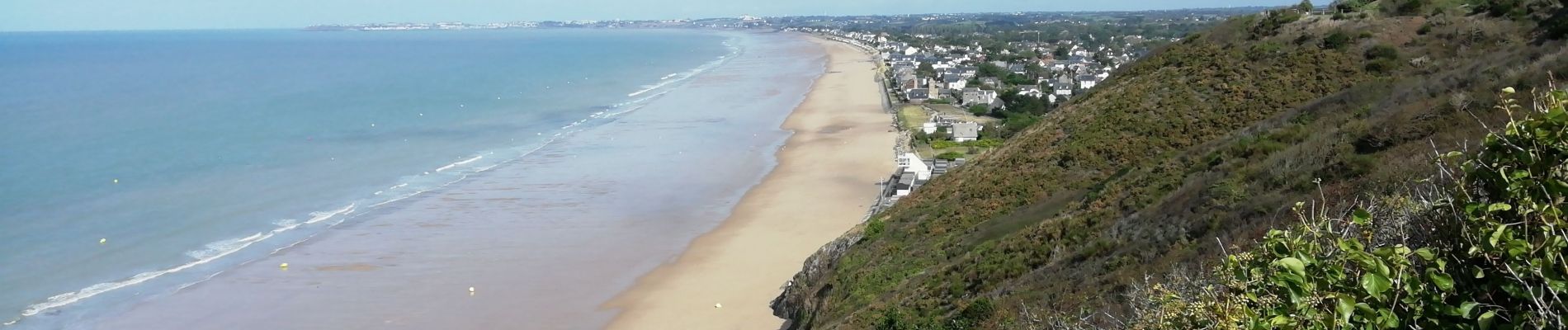
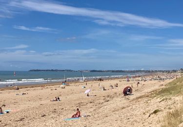
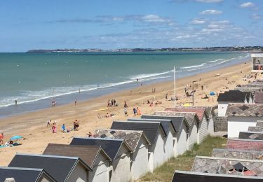
Trail Walking of 4.1 km to be discovered at Normandy, Manche, Carolles. This trail is proposed by SyMA.

Description

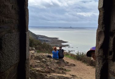
Départ de point de vue  parking en haut de falaises
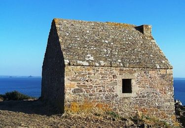
jusque cabane Vauban

Elevation profile

Photos

Positioning

Country:
France
Region :
Normandy
Department/Province :
Manche
Municipality :
Carolles
Location:
Unknown
Start:(UTM)
604971 ; 5401451 (30U) N.

Trails nearby

Trail Walking Carolles - La Vallée du Lude - Carolles - Photo
Walking
tracegps

Walking

Medium
(1)
Carolles, Normandy, Manche, France
6.7 km | 8.6 km-effort
2h 30min
No
Trail Walking Jullouville - Jullouville - Carolles - Photo
Walking
serleb

Walking

Medium
Jullouville, Normandy, Manche, France
7.4 km | 8.6 km-effort
2h 4min
No
Trail Walking Carolles - Carolles - Photo
Walking
serleb

Walking

Difficult
Carolles, Normandy, Manche, France
9.7 km | 12 km-effort
3h 7min
Yes
Trail Walking Carolles - Cabane Vauban et port du Lude - Photo
Walking
Vasseur Jean Marc

Walking

Easy
Carolles, Normandy, Manche, France
4.4 km | 5.7 km-effort
2h 17min
Yes
Trail Walking Carolles - cabane vauban - Photo
Walking
lionelnottat

Walking

Medium
Carolles, Normandy, Manche, France
6.8 km | 8.6 km-effort
1h 53min
Yes
Trail Mountain bike Jullouville - Bouillon Granville VTT - Photo
Mountain bike
pln

Mountain bike

Medium
Jullouville, Normandy, Manche, France
27 km | 31 km-effort
2h 51min
No
Trail Walking Saint-Jean-le-Thomas - 02-chemin du Mont Saint Michel  - Photo
Walking
bene_dictus77

Walking

Easy
Saint-Jean-le-Thomas, Normandy, Manche, France
23 km | 25 km-effort
8h 48min
No
Trail Walking Carolles - AMLC-50 Falaises de Champeaux à Carolles - Photo
Walking
dmj41

Walking

Difficult
Carolles, Normandy, Manche, France
11.6 km | 14.6 km-effort
3h 18min
Yes
Trail Road bike Jullouville - JULLOUVILLE MONT SAINT MICHEL 2022 - Photo
Road bike
leclaude74

Road bike

Difficult
Jullouville, Normandy, Manche, France
105 km | 116 km-effort
4h 1min
Yes


Close
My subscriptions