


champsaur .depart le clos de charance . les cretes de charance

gerardmicheline
User

Length
17.6 km

Max alt
1889 m

Uphill gradient
1275 m
Km-Effort
35 km

Min alt
1051 m

Downhill gradient
1274 m
Boucle
Yes
Creation date :
2019-10-02 16:03:26.722
Updated on :
2019-10-02 16:10:33.423
--
Difficulty : Difficult

FREE GPS app for hiking
 SityTrail
IGN / Geographical institutes
SityTrail Plus
The world is yours!
About
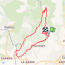
Trail On foot of 17.6 km to be discovered at Provence-Alpes-Côte d'Azur, Hautes-Alpes, Gap. This trail is proposed by gerardmicheline.
Positioning
Country:
France
Region :
Provence-Alpes-Côte d'Azur
Department/Province :
Hautes-Alpes
Municipality :
Gap
Location:
Gap
Start:(Dec)
Start:(UTM)
266547 ; 4940767 (32T) N.
Comments