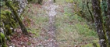
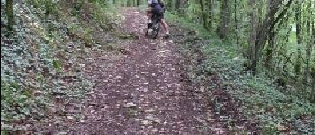
Trail Mountain bike Chauffour-sur-Vell - Le bois de l'empire - Photo
 sdroneau
sdroneau

User

© OpenStreetMap contributors
Length
Length
26 km
Max alt
Max alt
338 m
Uphill gradient
Uphill gradient
596 m
Km-Effort
Km-Effort  
34 km
Min alt
Min alt
118 m
Downhill gradient
Downhill gradient
599 m
Boucle
Boucle
Yes
Creation date :
2014-12-10 00:00:00.0
Updated on :
2014-12-10 00:00:00.0

(1 Reviews)

Mountain bike
Mountain bike
3h00
Difficulty : Difficult

Scan this QR Code to open this trail in the SityTrail application

FREE GPS app for hiking

Logo SityTrail SityTrail

IGN / Geographical institutes

Download SityTrail from the App Store Download SityTrail from Google Play

Logo SityTrail SityTrail Plus

The world is yours!

Download SityTrail from the App Store Download SityTrail from Google Play Download SityTrail on Huawei AppGallery

About

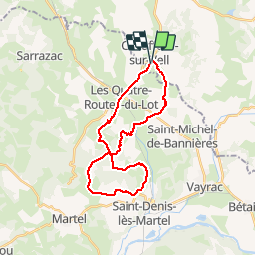
Trail Mountain bike of 26 km to be discovered at New Aquitaine, Corrèze, Chauffour-sur-Vell. This trail is proposed by sdroneau.

Description

Départ du stade de Chauffour sur Vell. Après avoir traversé le marais de la Fondial, grimpez en direction du château de Langlade. Une fois sur le plateau, une très belle descente vous permettra de rejoindre le magnifique village de Loupchat. Faites le tour du bois de l'Empire jusqu'au château de Terme. Après une descente technique, il faut remonter en direction de Strenquels. L'arrivée n'est plus très loin...

Elevation profile

Photos

Points of interest

Point of interest Martel - Descente vers Loupchet - Photo
sdroneau
Point of interest Saint-Denis-lès-Martel - Montée vers Strenquels - Photo
sdroneau
SAINT-DENIS-LÈS-MARTEL 

Positioning

Country:
France
Region :
New Aquitaine
Department/Province :
Corrèze
Municipality :
Chauffour-sur-Vell
Location:
Unknown
Start:(UTM)
394924 ; 4985212 (31T) N.

Comments

Please log in to post a review or rate the element


Superbe rando, avec de belles descentes, des belles grimpettes et de supers singles dans les bois. elle est complète !


Close
My subscriptions