


Refuge des souffles.

Dervalmarc
User
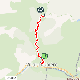

Length
4.5 km

Max alt
1975 m

Uphill gradient
922 m
Km-Effort
13.7 km

Min alt
1052 m

Downhill gradient
9 m
Boucle
No
Creation date :
2019-10-03 12:13:28.493
Updated on :
2019-10-03 14:52:26.903
2h01
Difficulty : Medium

FREE GPS app for hiking
 SityTrail
IGN / Geographical institutes
SityTrail Plus
The world is yours!
About
Trail Walking of 4.5 km to be discovered at Provence-Alpes-Côte d'Azur, Hautes-Alpes, Villar-Loubière. This trail is proposed by Dervalmarc.
Description
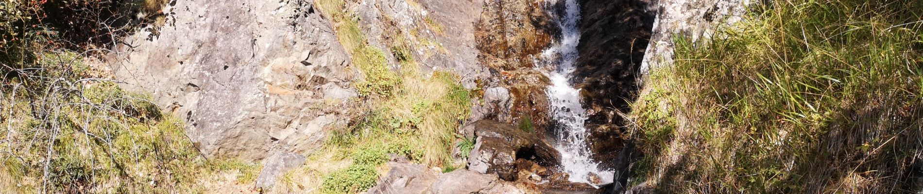
Cadre idillique.
Ambiance canadienne.
Photos


Positioning
Country:
France
Region :
Provence-Alpes-Côte d'Azur
Department/Province :
Hautes-Alpes
Municipality :
Villar-Loubière
Location:
Unknown
Start:(Dec)
Start:(UTM)
274255 ; 4967650 (32T) N.
Comments