Trail On foot Saint-Privat-de-Champclos - L'ermitage de St Ferreol -St Privat de Champclos-03/10/19 - Photo

L'ermitage de St Ferreol -St Privat de Champclos-03/10/19

 fario
fario

User

© OpenStreetMap contributors
Length
Length
15.2 km
Max alt
Max alt
279 m
Uphill gradient
Uphill gradient
478 m
Km-Effort
Km-Effort  
22 km
Min alt
Min alt
101 m
Downhill gradient
Downhill gradient
477 m
Boucle
Boucle
Yes
Creation date :
2019-10-03 07:54:19.175
Updated on :
2024-02-12 14:08:21.508

(0 Reviews)

On foot
On foot
4h54
Difficulty : Medium

Scan this QR Code to open this trail in the SityTrail application

FREE GPS app for hiking

Logo SityTrail SityTrail

IGN / Geographical institutes

Download SityTrail from the App Store Download SityTrail from Google Play

Logo SityTrail SityTrail World

The world is yours!

Download SityTrail from the App Store Download SityTrail from Google Play Download SityTrail on Huawei AppGallery

About

Trail On foot of 15.2 km to be discovered at Occitania, Gard, Saint-Privat-de-Champclos. This trail is proposed by fario.

Description

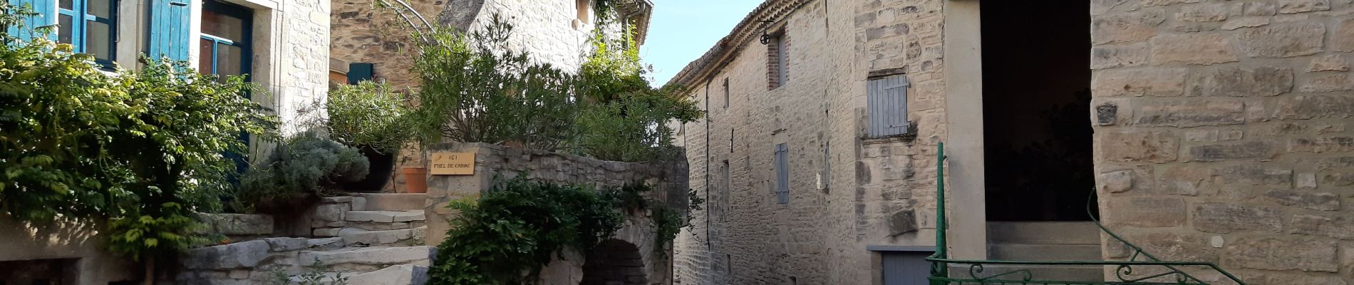
Randonnée agréable au départ de la Mairie de Champclos,  
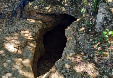
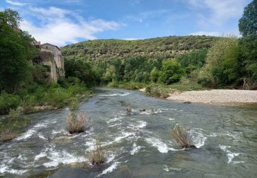
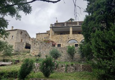
Nous traversons Cabiac, très beau village et nous allons au serre du Barri au nous montons à l'Oppidum, dont il ne reste que le tour  sur un chemin de pierre. Nous allons à l'ermitage de St Ferréol, belle bâtisse, avec une petite chapelle ouverte (assez rare). Nous descendons à la Cèze où nous piqueniquons . Après le repas nous repartons et rapidement une belle montée assez raide s'offre à notre digestion. Puis nous allons au château de Ferreyrolles , beaux vestiges surplombant la Cèze. Retour par le sentier de découverte / santé .

Elevation profile

Photos

Positioning

Country:
France
Region :
Occitania
Department/Province :
Gard
Municipality :
Saint-Privat-de-Champclos
Location:
Unknown
Start:(UTM)
608310 ; 4904442 (31T) N.

Trails nearby

Trail Walking Saint-Privat-de-Champclos - Château de Ferreyrolle - Photo
Walking
GUIDE
nadinebondoux

Walking

Medium
Saint-Privat-de-Champclos, Occitania, Gard, France
16.9 km | 24 km-effort
6h 8min
Yes
Trail Walking Montclus - Montclus - Photo
Walking
PhilippeetEvelyne

Walking

Medium
Montclus, Occitania, Gard, France
6.3 km | 9.6 km-effort
1h 36min
Yes
Trail Walking Montclus - montclus - Photo
Walking
toinou30

Walking

Medium
Montclus, Occitania, Gard, France
17.8 km | 26 km-effort
6h 13min
Yes
Trail Walking Tharaux - Tharaux la Cèze  - Photo
Walking
GUIDE
nadinebondoux

Walking

Medium
Tharaux, Occitania, Gard, France
18.8 km | 25 km-effort
6h 11min
Yes
Trail Walking Méjannes-le-Clap - Méjane le Clap-la Ceze - Photo
Walking
JMJ42

Walking

Medium
Méjannes-le-Clap, Occitania, Gard, France
15 km | 20 km-effort
4h 51min
Yes
Trail Walking Tharaux - Randonnée Tharaux - Photo
Walking
poisson1103

Walking

Easy
Tharaux, Occitania, Gard, France
11 km | 15.4 km-effort
3h 28min
No
Trail Walking Méjannes-le-Clap - SVG 180627 - Photo
Walking
randodan

Walking

Very easy
Méjannes-le-Clap, Occitania, Gard, France
8.2 km | 11.4 km-effort
3h 0min
No
Trail Walking Méjannes-le-Clap - 180627 EnCours - Photo
Walking
randodan

Walking

Very easy
Méjannes-le-Clap, Occitania, Gard, France
8.2 km | 11.3 km-effort
2h 50min
No
Trail Mountain bike Barjac - barjac - la bastide de Virac - Photo
Mountain bike
ledrede30

Mountain bike

Difficult
(3)
Barjac, Occitania, Gard, France
28 km | 36 km-effort
Unknown
Yes


Close
My subscriptions