


Largitzen-Hirtzbach

bubu90
User
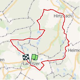

Length
18.6 km

Max alt
427 m

Uphill gradient
310 m
Km-Effort
23 km

Min alt
304 m

Downhill gradient
309 m
Boucle
Yes
Creation date :
2019-10-04 08:06:24.646
Updated on :
2019-10-04 12:33:25.042
--
Difficulty : Easy

FREE GPS app for hiking
 SityTrail
IGN / Geographical institutes
SityTrail Plus
The world is yours!
About
Trail Walking of 18.6 km to be discovered at Grand Est, Haut-Rhin, Largitzen. This trail is proposed by bubu90.
Positioning
Country:
France
Region :
Grand Est
Department/Province :
Haut-Rhin
Municipality :
Largitzen
Location:
Unknown
Start:(Dec)
Start:(UTM)
363629 ; 5269136 (32T) N.
Comments