


Épine et Drière

pzellner
User

Length
46 km

Max alt
1477 m

Uphill gradient
2749 m
Km-Effort
82 km

Min alt
287 m

Downhill gradient
2740 m
Boucle
Yes
Creation date :
2014-12-10 00:00:00.0
Updated on :
2014-12-10 00:00:00.0
10h00
Difficulty : Difficult

FREE GPS app for hiking
 SityTrail
IGN / Geographical institutes
SityTrail Plus
The world is yours!
About
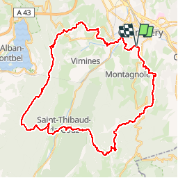
Trail Running of 46 km to be discovered at Auvergne-Rhône-Alpes, Savoy, Jacob-Bellecombette. This trail is proposed by pzellner.
Positioning
Country:
France
Region :
Auvergne-Rhône-Alpes
Department/Province :
Savoy
Municipality :
Jacob-Bellecombette
Location:
Unknown
Start:(Dec)
Start:(UTM)
727613 ; 5048872 (31T) N.
Comments