


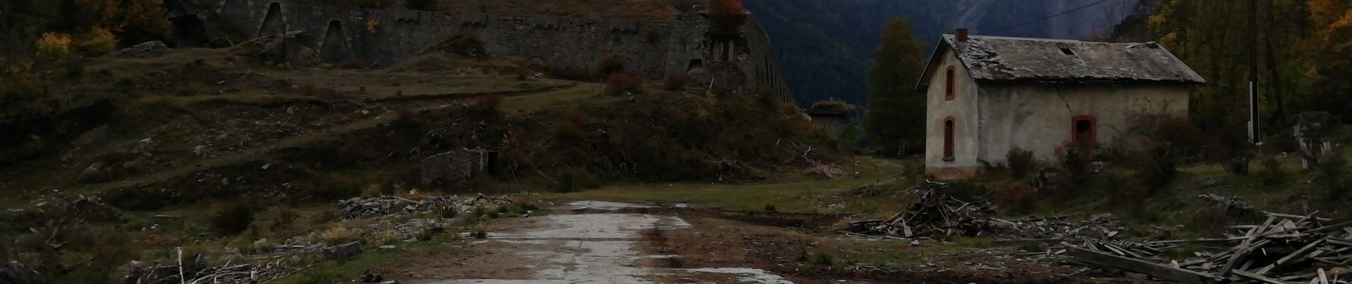
Mdane / Fort du Replaton

laurentnecca
User
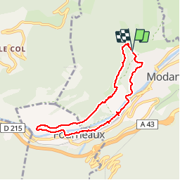

Length
7.2 km

Max alt
1219 m

Uphill gradient
187 m
Km-Effort
9.7 km

Min alt
1048 m

Downhill gradient
196 m
Boucle
Yes
Creation date :
2019-10-20 12:07:14.617
Updated on :
2019-10-21 22:31:24.646
2h02
Difficulty : Easy

FREE GPS app for hiking
 SityTrail
IGN / Geographical institutes
SityTrail Plus
The world is yours!
About
Trail Walking of 7.2 km to be discovered at Auvergne-Rhône-Alpes, Savoy, Modane. This trail is proposed by laurentnecca.
Photos


Positioning
Country:
France
Region :
Auvergne-Rhône-Alpes
Department/Province :
Savoy
Municipality :
Modane
Location:
Unknown
Start:(Dec)
Start:(UTM)
316590 ; 5008460 (32T) N.
Comments