Trail Walking Génolhac - Lundi 29 octobre - Photo

Lundi 29 octobre

 clerouin
clerouin

User

© OpenStreetMap contributors
Length
Length
3.6 km
Max alt
Max alt
712 m
Uphill gradient
Uphill gradient
241 m
Km-Effort
Km-Effort  
6.1 km
Min alt
Min alt
472 m
Downhill gradient
Downhill gradient
13 m
Boucle
Boucle
No
Creation date :
2019-10-28 14:32:32.0
Updated on :
2019-10-28 18:21:51.784

(0 Reviews)

Walking
Walking
2h04
Difficulty : Medium

Scan this QR Code to open this trail in the SityTrail application

FREE GPS app for hiking

Logo SityTrail SityTrail

IGN / Geographical institutes

Download SityTrail from the App Store Download SityTrail from Google Play

Logo SityTrail SityTrail World

The world is yours!

Download SityTrail from the App Store Download SityTrail from Google Play Download SityTrail on Huawei AppGallery

About

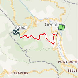
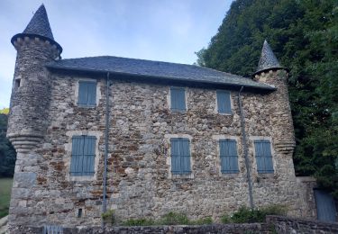
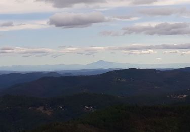
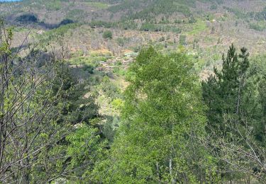
Trail Walking of 3.6 km to be discovered at Occitania, Gard, Génolhac. This trail is proposed by clerouin.

Description

De la gare Genolhac au gite Mas Nouveau

Elevation profile

Positioning

Country:
France
Region :
Occitania
Department/Province :
Gard
Municipality :
Génolhac
Location:
Unknown
Start:(UTM)
575824 ; 4910879 (31T) N.

Trails nearby

Trail Walking Vialas - Sentier de l'Avès depuis le Coupétadou - Photo
Walking
alfreson

Walking

Medium
(1)
Vialas, Occitania, Lozère, France
15.3 km | 23 km-effort
4h 51min
Yes
Trail Walking Aujac - GRP Haute Vallée de la Cèze  - Photo
Walking
GUIDE
nadinebondoux

Walking

Difficult
Aujac, Occitania, Gard, France
16.1 km | 26 km-effort
5h 39min
No
Trail Walking Ventalon en Cévennes - Sentier de l'Avès - Photo
Walking
GUIDE
nadinebondoux

Walking

Medium
Ventalon en Cévennes, Occitania, Lozère, France
14.7 km | 22 km-effort
4h 24min
Yes
Trail Walking Concoules - 2023-01-22_15h09m14_Cirkwi-La_Virado_del_Ronc - Photo
Walking
Levant

Walking

Difficult
(1)
Concoules, Occitania, Gard, France
9.3 km | 15.6 km-effort
3h 32min
Yes
Trail Walking Génolhac - Vallée de l'Homol - Photo
Walking
GUIDE
nadinebondoux

Walking

Difficult
(1)
Génolhac, Occitania, Gard, France
16 km | 24 km-effort
5h 5min
Yes
Trail Walking Vialas - sud Mont Lozère de Vialas  - Photo
Walking
GUIDE
nadinebondoux

Walking

Difficult
Vialas, Occitania, Lozère, France
17.5 km | 29 km-effort
6h 4min
Yes
Trail Walking Sénéchas - sentier du Quinsonnet - Photo
Walking
GUIDE
nadinebondoux

Walking

Medium
Sénéchas, Occitania, Gard, France
10.9 km | 17 km-effort
3h 21min
Yes
Trail Walking Chamborigaud - Ronde des crêtes - Photo
Walking
GUIDE
nadinebondoux

Walking

Medium
Chamborigaud, Occitania, Gard, France
21 km | 30 km-effort
5h 39min
Yes
Trail Walking Aujac - Aujac Malons et Elze - Photo
Walking
GUIDE
Roger Philippe Wallez

Walking

Very difficult
Aujac, Occitania, Gard, France
16.4 km | 26 km-effort
6h 2min
No


Close
My subscriptions