


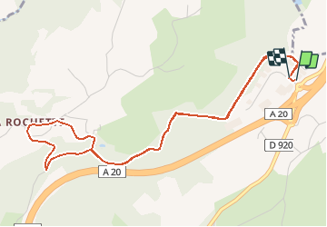
Sentier de la Rochette à Donzenac

houbart
User

Length
6 km

Max alt
375 m

Uphill gradient
135 m
Km-Effort
7.8 km

Min alt
281 m

Downhill gradient
134 m
Boucle
Yes
Creation date :
2019-11-03 09:43:02.355
Updated on :
2019-11-03 13:43:00.058
1h39
Difficulty : Medium

FREE GPS app for hiking
 SityTrail
IGN / Geographical institutes
SityTrail Plus
The world is yours!
About
Trail Walking of 6 km to be discovered at New Aquitaine, Corrèze, Donzenac. This trail is proposed by houbart.


Positioning
Country:
France
Region :
New Aquitaine
Department/Province :
Corrèze
Municipality :
Donzenac
Location:
Unknown
Start:(Dec)
Start:(UTM)
385305 ; 5012048 (31T) N.
Comments