Trail Walking Saint-Étienne-le-Laus - N.D. du Laus - Col de l'Ange - Photo
© OpenStreetMap contributors
Length
Length
4.8 km
Max alt
Max alt
1123 m
Uphill gradient
Uphill gradient
251 m
Km-Effort
Km-Effort  
8.1 km
Min alt
Min alt
883 m
Downhill gradient
Downhill gradient
251 m
Boucle
Boucle
Yes
Creation date :
2019-11-13 09:11:14.41
Updated on :
2019-11-13 17:06:05.168

(0 Reviews)

Walking
Walking
2h30
Difficulty : Very easy

Scan this QR Code to open this trail in the SityTrail application

FREE GPS app for hiking

Logo SityTrail SityTrail

IGN / Geographical institutes

Download SityTrail from the App Store Download SityTrail from Google Play

Logo SityTrail SityTrail World

The world is yours!

Download SityTrail from the App Store Download SityTrail from Google Play Download SityTrail on Huawei AppGallery

About

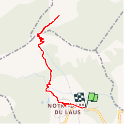
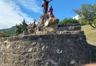
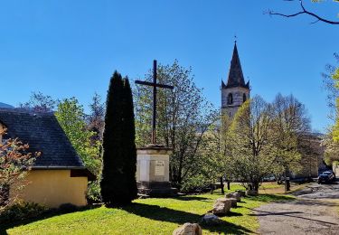
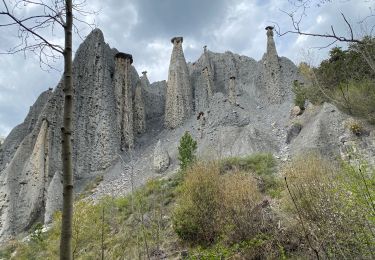
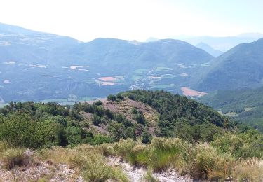
Trail Walking of 4.8 km to be discovered at Provence-Alpes-Côte d'Azur, Hautes-Alpes, Saint-Étienne-le-Laus. This trail is proposed by Daniel.BRUN-PICARD.

Description

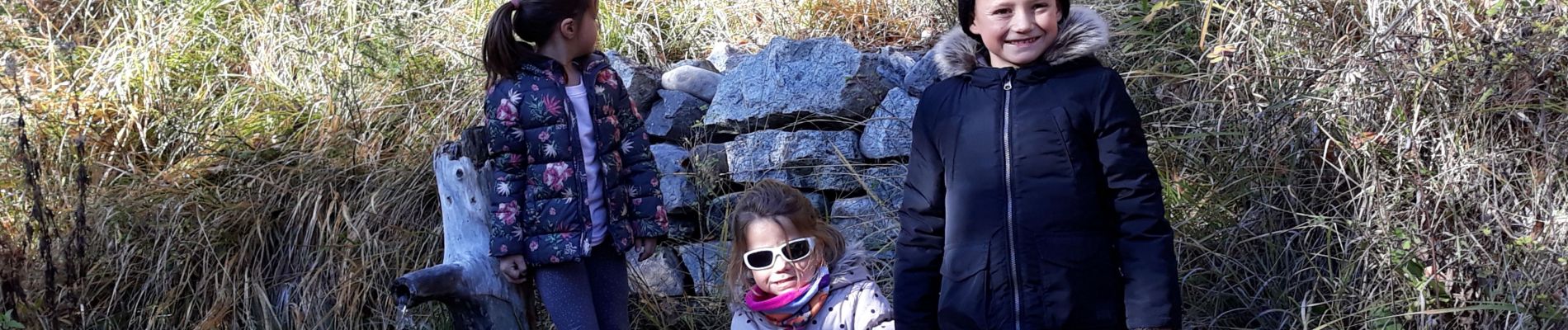
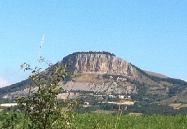
Petite randonnée d'automne, avec des enfants de 8, 6 et 4 ans. Facile et offrant de très beaux points de vue sur N.D. du Laus et les montagnes.

Elevation profile

Photos

Positioning

Country:
France
Region :
Provence-Alpes-Côte d'Azur
Department/Province :
Hautes-Alpes
Municipality :
Saint-Étienne-le-Laus
Location:
Unknown
Start:(UTM)
274001 ; 4933669 (32T) N.

Trails nearby

Trail Walking Jarjayes - VALSAIRES CHAPELLE NOTRE DAME DU LAIS - Photo
Walking
RobinMicheline

Walking

Difficult
Jarjayes, Provence-Alpes-Côte d'Azur, Hautes-Alpes, France
14.2 km | 23 km-effort
4h 25min
Yes
Trail Walking Valserres - Chapelle Saint Maurice.  - Photo
Walking
Dervalmarc

Walking

Medium
Valserres, Provence-Alpes-Côte d'Azur, Hautes-Alpes, France
12.9 km | 23 km-effort
3h 51min
No
Trail Mountain bike Gap - pjpc gap - Photo
Mountain bike
franck05

Mountain bike

Medium
(1)
Gap, Provence-Alpes-Côte d'Azur, Hautes-Alpes, France
29 km | 41 km-effort
2h 59min
Yes
Trail Walking La Bâtie-Vieille - Circuit de l'Hermitage - Photo
Walking
frederique.marti@laposte.net

Walking

Very easy
La Bâtie-Vieille, Provence-Alpes-Côte d'Azur, Hautes-Alpes, France
12.1 km | 15.9 km-effort
2h 22min
Yes
Trail Walking Saint-Étienne-le-Laus - Statue de l'Ange - Puy Maurel - Pas du Lièvre - Photo
Walking
PapouBertrand

Walking

Very difficult
Saint-Étienne-le-Laus, Provence-Alpes-Côte d'Azur, Hautes-Alpes, France
11.9 km | 19.9 km-effort
4h 32min
Yes
Trail Walking Saint-Étienne-le-Laus - ND du Laus, Col de l'Ange, Pas du Lièvre - Photo
Walking
PapouBertrand

Walking

Difficult
Saint-Étienne-le-Laus, Provence-Alpes-Côte d'Azur, Hautes-Alpes, France
8.4 km | 14.1 km-effort
3h 12min
Yes
Trail Walking Théus - Demoiselles  - Photo
Walking
Nuance

Walking

Medium
Théus, Provence-Alpes-Côte d'Azur, Hautes-Alpes, France
5.5 km | 10.3 km-effort
2h 16min
Yes
Trail Walking La Bâtie-Vieille - 16 km - Photo
Walking
goffinm@gmail.com

Walking

Difficult
La Bâtie-Vieille, Provence-Alpes-Côte d'Azur, Hautes-Alpes, France
16 km | 23 km-effort
4h 11min
Yes
Trail Walking Rambaud - Rambaud - La batie vieille - Photo
Walking
GUIDE
R@ph

Walking

Medium
Rambaud, Provence-Alpes-Côte d'Azur, Hautes-Alpes, France
8.5 km | 11.9 km-effort
2h 32min
Yes


Close
My subscriptions