


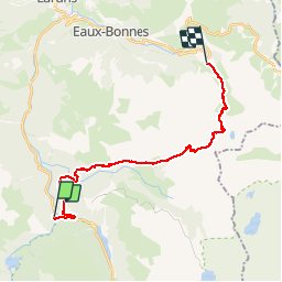
Gabas - Gourette

ARVIEU
User

Length
22 km

Max alt
2466 m

Uphill gradient
1720 m
Km-Effort
44 km

Min alt
1034 m

Downhill gradient
1382 m
Boucle
No
Creation date :
2019-12-01 10:32:07.878
Updated on :
2019-12-01 10:34:29.494
10h00
Difficulty : Difficult

FREE GPS app for hiking
 SityTrail
IGN / Geographical institutes
SityTrail Plus
The world is yours!
About
Trail On foot of 22 km to be discovered at New Aquitaine, Pyrénées-Atlantiques, Laruns. This trail is proposed by ARVIEU.
Description
Corniche des Alhas, col de Hourquette d Arré, lac d Anglas
Positioning
Country:
France
Region :
New Aquitaine
Department/Province :
Pyrénées-Atlantiques
Municipality :
Laruns
Location:
Unknown
Start:(Dec)
Start:(UTM)
710085 ; 4751607 (30T) N.
Comments