


Steinbach-Cascades-Becherkopf

JCLUTT
User
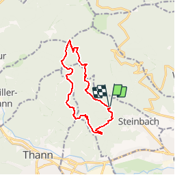

Length
11.7 km

Max alt
913 m

Uphill gradient
609 m
Km-Effort
19.8 km

Min alt
413 m

Downhill gradient
604 m
Boucle
Yes
Creation date :
2019-12-04 07:45:46.434
Updated on :
2019-12-06 11:09:42.308
--
Difficulty : Difficult

FREE GPS app for hiking
 SityTrail
IGN / Geographical institutes
SityTrail Plus
The world is yours!
About
Trail On foot of 11.7 km to be discovered at Grand Est, Haut-Rhin, Steinbach. This trail is proposed by JCLUTT.
Positioning
Country:
France
Region :
Grand Est
Department/Province :
Haut-Rhin
Municipality :
Steinbach
Location:
Unknown
Start:(Dec)
Start:(UTM)
360684 ; 5298687 (32T) N.
Comments