


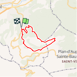
Auriol ravin des infernets

bernir
User

Length
12.1 km

Max alt
739 m

Uphill gradient
542 m
Km-Effort
19.4 km

Min alt
244 m

Downhill gradient
542 m
Boucle
Yes
Creation date :
2019-12-06 08:29:12.606
Updated on :
2019-12-06 20:32:56.258
5h46
Difficulty : Difficult

FREE GPS app for hiking
 SityTrail
IGN / Geographical institutes
SityTrail Plus
The world is yours!
About
Trail Walking of 12.1 km to be discovered at Provence-Alpes-Côte d'Azur, Bouches-du-Rhône, Auriol. This trail is proposed by bernir.
Positioning
Country:
France
Region :
Provence-Alpes-Côte d'Azur
Department/Province :
Bouches-du-Rhône
Municipality :
Auriol
Location:
Unknown
Start:(Dec)
Start:(UTM)
715553 ; 4803235 (31T) N.
Comments