Auriol, Bouches-du-Rhône: Best trails, routes and walks

7 comments

Auriol: Discover the best trails: 79 hiking trails and 16 bike and mountain-bike routes. All these trails, routes and outdoor activities are available in our SityTrail applications for smartphones and tablets.


The best trails (98)

Trail Walking Auriol - la crete des infernets - Photo
Walking 8.551
Km

Walking

Difficult
(1)
Auriol, Provence-Alpes-Côte d'Azur, Bouches-du-Rhône, France
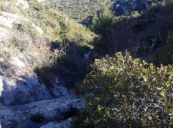
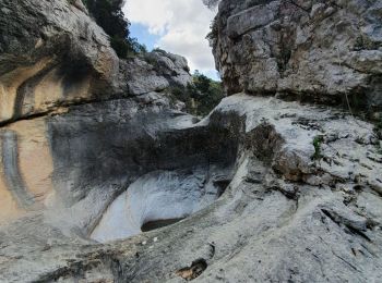
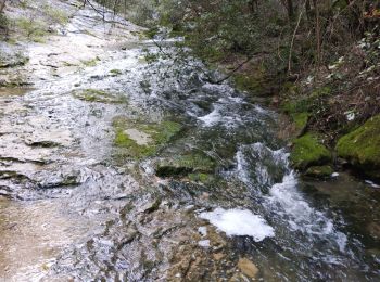
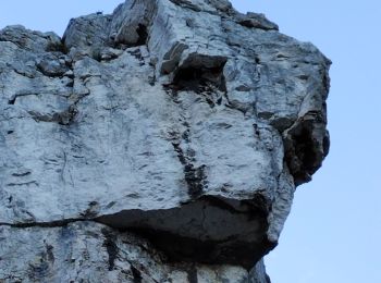
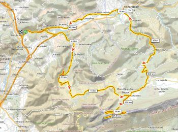
8.6 km | 14 km-effort
3h 22min
408 m
410 m
Yes
Coryphene

Trail On foot Auriol - Les moulins - Photo
On foot 3.663
Km
PRO

On foot

Easy
Auriol, Provence-Alpes-Côte d'Azur, Bouches-du-Rhône, France
3.7 km | 4.2 km-effort
57min
41 m
43 m
Yes
SityTrail - itinéraires balisés pédestres

• Trail created by Fédération française de la randonnée pédestre.

Trail Walking Auriol - le ravin des Encanaux - Photo
Walking 7.334
Km
GUIDE

Walking

Difficult
Auriol, Provence-Alpes-Côte d'Azur, Bouches-du-Rhône, France
7.3 km | 12.2 km-effort
3h 10min
364 m
363 m
Yes
amiral13

Trail Walking Auriol - les Encanaux  - Photo
Walking 7.108
Km

Walking

Difficult
Auriol, Provence-Alpes-Côte d'Azur, Bouches-du-Rhône, France
7.1 km | 11 km-effort
2h 14min
297 m
291 m
Yes
cousam

Trail Walking Auriol - Ravin des Infernets -Tête de chien - Photo
Walking 13.674
Km

Walking

Very difficult
Auriol, Provence-Alpes-Côte d'Azur, Bouches-du-Rhône, France
13.7 km | 22 km-effort
9h 33min
632 m
625 m
Yes
cousam

Trail Walking Auriol - les Encanaux  - Photo
Walking 12.475
Km

Walking

Medium
(1)
Auriol, Provence-Alpes-Côte d'Azur, Bouches-du-Rhône, France
12.5 km | 21 km-effort
4h 51min
641 m
640 m
Yes
Marcsaintcyr

Trail Walking Auriol - les Encanaux  - Photo
Walking 13.007
Km

Walking

Medium
Auriol, Provence-Alpes-Côte d'Azur, Bouches-du-Rhône, France
13 km | 22 km-effort
4h 51min
645 m
643 m
Yes
Marcsaintcyr

Trail Walking Auriol - Auriol Roland - Photo
Walking 13.756
Km

Walking

Medium
Auriol, Provence-Alpes-Côte d'Azur, Bouches-du-Rhône, France
13.8 km | 22 km-effort
4h 49min
600 m
600 m
Yes
gaggiroland

Trail Walking Auriol - cauvin bertagne roqueforcade - Photo
Walking 13.227
Km

Walking

Very difficult
Auriol, Provence-Alpes-Côte d'Azur, Bouches-du-Rhône, France
13.2 km | 24 km-effort
4h 52min
810 m
808 m
Yes
cdanielrando

Trail On foot Auriol - plan aups - Photo
On foot 10.94
Km

On foot

Medium
Auriol, Provence-Alpes-Côte d'Azur, Bouches-du-Rhône, France
10.9 km | 15.6 km-effort
3h 32min
348 m
348 m
Yes
JosephRigolet

Trail On foot Auriol - encanaux infernets cauvin - Photo
On foot 12.757
Km

On foot

Medium
Auriol, Provence-Alpes-Côte d'Azur, Bouches-du-Rhône, France
12.8 km | 21 km-effort
4h 50min
643 m
643 m
Yes
cdanielrando

Trail Walking Auriol - Encanaux - Photo
Walking 12.552
Km

Walking

Medium
Auriol, Provence-Alpes-Côte d'Azur, Bouches-du-Rhône, France
12.6 km | 19.5 km-effort
3h 47min
522 m
523 m
Yes
sereton

Trail Walking Auriol - Ste Baume - Auriol :  Les trois ravins  - Photo
Walking 7.699
Km

Walking

Very easy
Auriol, Provence-Alpes-Côte d'Azur, Bouches-du-Rhône, France
7.7 km | 12.5 km-effort
4h 23min
356 m
386 m
No
phidge

Trail Mountain bike Auriol - Les Béguines et la Lare, deux crêtes de la Sainte-Baume, à vtt - Photo
Mountain bike 62.619
Km

Mountain bike

Very difficult
Auriol, Provence-Alpes-Côte d'Azur, Bouches-du-Rhône, France
63 km | 89 km-effort
8h 0min
2001 m
2001 m
Yes
tracegps

Trail sport Auriol - Auriol  - Photo
sport 25.565
Km

sport

Very easy
Auriol, Provence-Alpes-Côte d'Azur, Bouches-du-Rhône, France
26 km | 36 km-effort
Unknown
777 m
823 m
No
gaggiroland

Trail Road bike Auriol - Pic de Bertagne 1090m+ - Photo
Road bike 47.48
Km

Road bike

Very difficult
Auriol, Provence-Alpes-Côte d'Azur, Bouches-du-Rhône, France
47 km | 62 km-effort
3h 45min
1088 m
1088 m
Yes
ericberlin

Trail On foot Auriol - le tuny par le plan d'aups - Photo
On foot 10.094
Km

On foot

Medium
(1)
Auriol, Provence-Alpes-Côte d'Azur, Bouches-du-Rhône, France
10.1 km | 15.5 km-effort
6h 40min
401 m
412 m
Yes
Coryphene

Trail Walking Auriol - Les Encanaux - Crête de la Lare - Ravin des Infernets 2021-04-25 - Photo
Walking 13.792
Km

Walking

Very difficult
Auriol, Provence-Alpes-Côte d'Azur, Bouches-du-Rhône, France
13.8 km | 22 km-effort
6h 1min
619 m
620 m
Yes
pourrier

Trail Walking Auriol - Dents Roque Fourcade Tour de cauvin - Photo
Walking 13.649
Km

Walking

Medium
Auriol, Provence-Alpes-Côte d'Azur, Bouches-du-Rhône, France
13.6 km | 19.7 km-effort
5h 46min
453 m
452 m
Yes
immortelles2020

Trail Other activity Auriol - Encanaux - Coutronne - Photo
Other activity 8.241
Km

Other activity

Very easy
Auriol, Provence-Alpes-Côte d'Azur, Bouches-du-Rhône, France
8.2 km | 13.3 km-effort
6h 6min
379 m
383 m
Yes
RANDOTOURVES02

20 trails displayed on 98

FREE GPS app for hiking

Logo SityTrail SityTrail

IGN / Geographical institutes

Download SityTrail from the App Store Download SityTrail from Google Play

Logo SityTrail SityTrail World

The world is yours!

Download SityTrail from the App Store Download SityTrail from Google Play Download SityTrail on Huawei AppGallery

Activities

Close
My subscriptions