


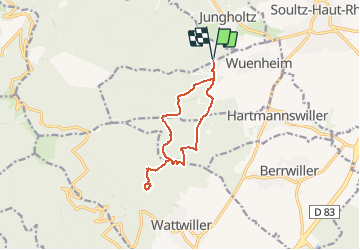
TL 11/19 Stand de Tir Wuenheim - Sandgrubenkopf - Hirtzenstein et retour par La Cantine Zeller

patrickbeyrath
User

Length
11.1 km

Max alt
677 m

Uphill gradient
485 m
Km-Effort
17.6 km

Min alt
349 m

Downhill gradient
485 m
Boucle
Yes
Creation date :
2019-12-10 07:18:53.774
Updated on :
2019-12-17 06:18:16.012
--
Difficulty : Medium

FREE GPS app for hiking
 SityTrail
IGN / Geographical institutes
SityTrail Plus
The world is yours!
About
Trail On foot of 11.1 km to be discovered at Grand Est, Haut-Rhin, Soultz-Haut-Rhin. This trail is proposed by patrickbeyrath.
Description
Stand de Tir - Bois d'Ollwiller - Sandgrubenkopf - Hirtzenstein - La Cantine Zeller - Gauchbach et retour
Positioning
Country:
France
Region :
Grand Est
Department/Province :
Haut-Rhin
Municipality :
Soultz-Haut-Rhin
Location:
Unknown
Start:(Dec)
Start:(UTM)
364774 ; 5304018 (32T) N.
Comments