


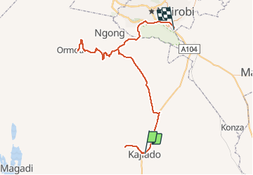
Kajiado day 2

fabrice.delfosse
User

Length
189 km

Max alt
2051 m

Uphill gradient
2587 m
Km-Effort
223 km

Min alt
1589 m

Downhill gradient
2689 m
Boucle
No
Creation date :
2019-12-10 05:12:17.531
Updated on :
2019-12-10 17:14:38.41
10h57
Difficulty : Medium

FREE GPS app for hiking
 SityTrail
IGN / Geographical institutes
SityTrail World
The world is yours!
About
Trail 4x4 of 189 km to be discovered at Kajiado County. This trail is proposed by fabrice.delfosse.
Positioning
Country:
Kenya
Region :
Kajiado County
Department/Province :
Unknown
Municipality :
Unknown
Location:
Unknown
Start:(Dec)
Start:(UTM)
254205 ; 9796211 (37M) S.
Comments
Trails nearby