Trail Walking Caussols - caussols - Photo
© OpenStreetMap contributors
Length
Length
4.4 km
Max alt
Max alt
1280 m
Uphill gradient
Uphill gradient
179 m
Km-Effort
Km-Effort  
6.8 km
Min alt
Min alt
1098 m
Downhill gradient
Downhill gradient
179 m
Boucle
Boucle
Yes
Creation date :
2014-12-10 00:00:00.0
Updated on :
2014-12-10 00:00:00.0

(0 Reviews)

Walking
Walking
1h49
Difficulty : Easy

Scan this QR Code to open this trail in the SityTrail application

FREE GPS app for hiking

Logo SityTrail SityTrail

IGN / Geographical institutes

Download SityTrail from the App Store Download SityTrail from Google Play

Logo SityTrail SityTrail World

The world is yours!

Download SityTrail from the App Store Download SityTrail from Google Play Download SityTrail on Huawei AppGallery

About

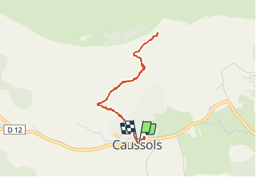
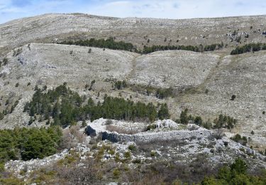
Trail Walking of 4.4 km to be discovered at Provence-Alpes-Côte d'Azur, Maritime Alps, Caussols. This trail is proposed by xtofimbert.

Description

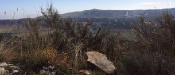
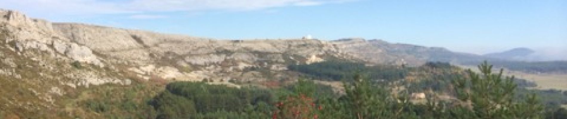
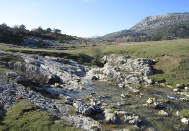
Ballade sympa et vue superbe en cadeau

Elevation profile

Photos

Points of interest

Point of interest Caussols - pause avec vue agréable  - Photo
xtofimbert

Positioning

Country:
France
Region :
Provence-Alpes-Côte d'Azur
Department/Province :
Maritime Alps
Municipality :
Caussols
Location:
Unknown
Start:(UTM)
330920 ; 4845295 (32T) N.

Trails nearby

Trail Walking Caussols - Traversée du Gros Pounch 1270 m, depuis le Col de la Sine - Photo
Walking
tracegps

Walking

Easy
(2)
Caussols, Provence-Alpes-Côte d'Azur, Maritime Alps, France
14.7 km | 19.9 km-effort
4h 15min
Yes
Trail Walking Caussols - Le Haut Montet 1335m, Plateau de Caussols - Photo
Walking
tracegps

Walking

Easy
(1)
Caussols, Provence-Alpes-Côte d'Azur, Maritime Alps, France
13.5 km | 18.6 km-effort
4h 0min
Yes
Trail On foot Caussols - Plateau de Caussols - Photo
On foot
PRO

On foot

Easy
Caussols, Provence-Alpes-Côte d'Azur, Maritime Alps, France
13.9 km | 19.1 km-effort
4h 20min
Yes
Trail On foot Cipières - Traversée de l'Estéron - Etape 2 - Photo
On foot
PRO

On foot

Difficult
Cipières, Provence-Alpes-Côte d'Azur, Maritime Alps, France
21 km | 41 km-effort
9h 18min
No
Trail On foot Cipières - Traversée de l'Estéron - Etape 1 - Photo
On foot
PRO

On foot

Medium
Cipières, Provence-Alpes-Côte d'Azur, Maritime Alps, France
18.4 km | 29 km-effort
6h 28min
No
Trail On foot Cipières - Plateau de Calern - Photo
On foot
PRO

On foot

Medium
Cipières, Provence-Alpes-Côte d'Azur, Maritime Alps, France
13.5 km | 21 km-effort
4h 44min
Yes
Trail Walking Caussols - La Meute Plateau de Caussols 3 - Photo
Walking
DIDIERLESERT

Walking

Medium
(1)
Caussols, Provence-Alpes-Côte d'Azur, Maritime Alps, France
12.4 km | 17.2 km-effort
4h 0min
Yes
Trail Walking Caussols - La Meute Plateau de Caussols - Photo
Walking
DIDIERLESERT

Walking

Medium
(1)
Caussols, Provence-Alpes-Côte d'Azur, Maritime Alps, France
14.9 km | 20 km-effort
4h 17min
Yes
Trail Walking Saint-Vallier-de-Thiey - St Vallier de Thiey - Col du Ferrier - Castellaras de la Malle - Col du Pilon - Pierre Druidique - Photo
Walking
LtZIP

Walking

Medium
Saint-Vallier-de-Thiey, Provence-Alpes-Côte d'Azur, Maritime Alps, France
18.9 km | 28 km-effort
6h 18min
Yes


Close
My subscriptions