Trail Walking Labergement-Sainte-Marie - tour du lac st-point - Photo
 BM25
BM25

User

© OpenStreetMap contributors
Length
Length
18.5 km
Max alt
Max alt
913 m
Uphill gradient
Uphill gradient
319 m
Km-Effort
Km-Effort  
23 km
Min alt
Min alt
846 m
Downhill gradient
Downhill gradient
319 m
Boucle
Boucle
Yes
Creation date :
2020-01-02 08:58:21.75
Updated on :
2020-01-02 13:52:08.393

(0 Reviews)

Walking
Walking
4h52
Difficulty : Easy

Scan this QR Code to open this trail in the SityTrail application

FREE GPS app for hiking

Logo SityTrail SityTrail

IGN / Geographical institutes

Download SityTrail from the App Store Download SityTrail from Google Play

Logo SityTrail SityTrail World

The world is yours!

Download SityTrail from the App Store Download SityTrail from Google Play Download SityTrail on Huawei AppGallery

About

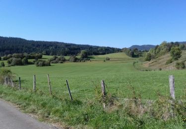
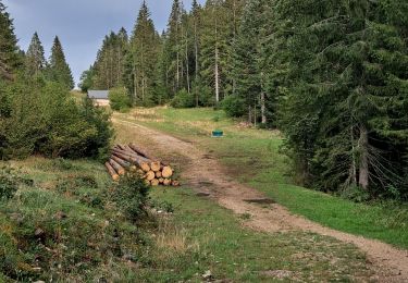
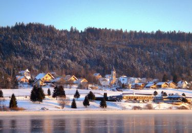
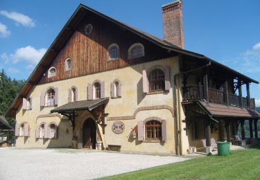
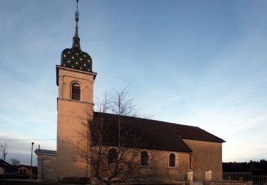
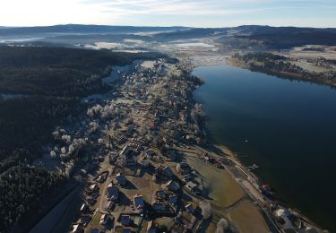
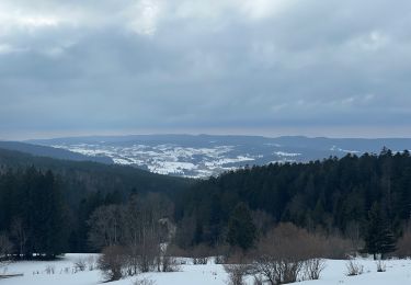
Trail Walking of 18.5 km to be discovered at Bourgogne-Franche-Comté, Doubs, Labergement-Sainte-Marie. This trail is proposed by BM25.

Description

depart pont vert direction rive gauche st-point

Elevation profile

Positioning

Country:
France
Region :
Bourgogne-Franche-Comté
Department/Province :
Doubs
Municipality :
Labergement-Sainte-Marie
Location:
Unknown
Start:(UTM)
292422 ; 5185035 (32T) N.

Trails nearby

Trail Walking Remoray-Boujeons - Remoray-Boujeons - Le Belvédère des deux Lacs - Photo
Walking
nicolibris

Walking

Difficult
(1)
Remoray-Boujeons, Bourgogne-Franche-Comté, Doubs, France
10.4 km | 13.8 km-effort
2h 58min
Yes
Trail Walking Remoray-Boujeons - Le Belvédère des 2 lacs - Doubs - Photo
Walking
tracegps

Walking

Difficult
(1)
Remoray-Boujeons, Bourgogne-Franche-Comté, Doubs, France
13.7 km | 19 km-effort
4h 0min
Yes
Trail Walking Saint-Antoine - Boucle du fort St Antoine  - Photo
Walking
mallovon

Walking

Medium
Saint-Antoine, Bourgogne-Franche-Comté, Doubs, France
4.8 km | 6.2 km-effort
1h 25min
Yes
Trail On foot Saint-Point-Lac - La Ronde des Deux Villages - Photo
On foot
PRO

On foot

Easy
Saint-Point-Lac, Bourgogne-Franche-Comté, Doubs, France
5.5 km | 7.3 km-effort
1h 40min
Yes
Trail On foot Les Grangettes - La Pierre qui Tourne - Photo
On foot
PRO

On foot

Easy
Les Grangettes, Bourgogne-Franche-Comté, Doubs, France
8.2 km | 10.7 km-effort
2h 25min
Yes
Trail On foot Malpas - Le Tour du Lac de Malpas - Photo
On foot
PRO

On foot

Easy
Malpas, Bourgogne-Franche-Comté, Doubs, France
4.9 km | 5.7 km-effort
1h 17min
Yes
Trail On foot Malbuisson - Sentier du Tour du Lac - Photo
On foot
PRO

On foot

Easy
Malbuisson, Bourgogne-Franche-Comté, Doubs, France
16 km | 19.9 km-effort
4h 30min
No
Trail Snowshoes Métabief - Les hauteurs de Metabief - Photo
Snowshoes
zefreefly

Snowshoes

Medium
Métabief, Bourgogne-Franche-Comté, Doubs, France
15.5 km | 23 km-effort
3h 51min
Yes
Trail Nordic walking Malbuisson - Fort St Antoine  - Photo
Nordic walking
mallovon

Nordic walking

Easy
Malbuisson, Bourgogne-Franche-Comté, Doubs, France
5.8 km | 7.3 km-effort
2h 21min
Yes


Close
My subscriptions