


piolit

gillesmanfredi
User
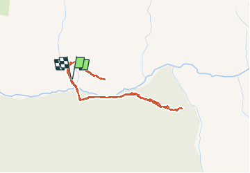

Length
3.9 km

Max alt
1574 m

Uphill gradient
209 m
Km-Effort
6.7 km

Min alt
1399 m

Downhill gradient
212 m
Boucle
Yes
Creation date :
2020-01-12 08:08:18.265
Updated on :
2020-01-13 18:33:16.896
1h39
Difficulty : Very easy

FREE GPS app for hiking
 SityTrail
IGN / Geographical institutes
SityTrail Plus
The world is yours!
About
Trail Touring skiing of 3.9 km to be discovered at Provence-Alpes-Côte d'Azur, Hautes-Alpes, Ancelle. This trail is proposed by gillesmanfredi.
Positioning
Country:
France
Region :
Provence-Alpes-Côte d'Azur
Department/Province :
Hautes-Alpes
Municipality :
Ancelle
Location:
Unknown
Start:(Dec)
Start:(UTM)
280108 ; 4944751 (32T) N.
Comments