Trail Walking Bas-en-Basset - george de l'andrable depuis le Vert - Photo

george de l'andrable depuis le Vert

© OpenStreetMap contributors
Length
Length
12.3 km
Max alt
Max alt
813 m
Uphill gradient
Uphill gradient
411 m
Km-Effort
Km-Effort  
17.7 km
Min alt
Min alt
474 m
Downhill gradient
Downhill gradient
405 m
Boucle
Boucle
Yes
Creation date :
2014-12-10 00:00:00.0
Updated on :
2014-12-10 00:00:00.0

(0 Reviews)

Walking
Walking
3h07
Difficulty : Easy

Scan this QR Code to open this trail in the SityTrail application

FREE GPS app for hiking

Logo SityTrail SityTrail

IGN / Geographical institutes

Download SityTrail from the App Store Download SityTrail from Google Play

Logo SityTrail SityTrail World

The world is yours!

Download SityTrail from the App Store Download SityTrail from Google Play Download SityTrail on Huawei AppGallery

About

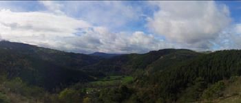
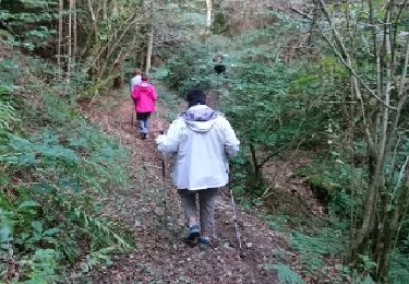
Trail Walking of 12.3 km to be discovered at Auvergne-Rhône-Alpes, Haute-Loire, Bas-en-Basset. This trail is proposed by acsglaurent.

Description

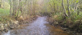
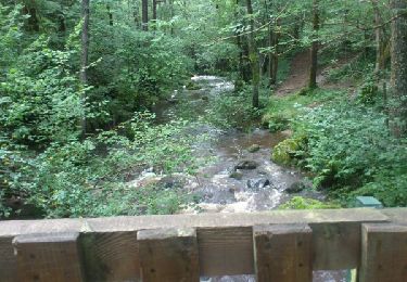
départ au niveau du pont qui enjambe l'andrable à la sortie du village du Vert en direction de Tirange
attention !
suivant les conditions métérologique les diverses traversées de la rivière peuvent etre impossible, il faut de préférence avoir une paire de botte sauf en période estivale

Elevation profile

Photos

Points of interest

Point of interest Bas-en-Basset - Point 1 - Photo
acsglaurent
BAS-EN-BASSET 
Point of interest Bas-en-Basset - Point 2 - Photo
acsglaurent
BAS-EN-BASSET 
Point of interest Valprivas - Point 3 - Photo
acsglaurent
VALPRIVAS 
Point of interest Bas-en-Basset - Point 8 - Photo
acsglaurent
BAS-EN-BASSET 

Positioning

Country:
France
Region :
Auvergne-Rhône-Alpes
Department/Province :
Haute-Loire
Municipality :
Bas-en-Basset
Location:
Unknown
Start:(UTM)
583992 ; 5014570 (31T) N.

Trails nearby

Trail Walking Bas-en-Basset - Le Tour du Malorum - Bas-en-Basset - Photo
Walking
tracegps

Walking

Medium
(2)
Bas-en-Basset, Auvergne-Rhône-Alpes, Haute-Loire, France
8.6 km | 13.4 km-effort
2h 30min
Yes
Trail Mountain bike Bas-en-Basset - Bas en basset_Rochebaron - Photo
Mountain bike
gabybaro

Mountain bike

Difficult
(1)
Bas-en-Basset, Auvergne-Rhône-Alpes, Haute-Loire, France
24 km | 33 km-effort
2h 30min
Yes
Trail Walking Boisset - saut du bezan - Photo
Walking
viverols

Walking

Medium
Boisset, Auvergne-Rhône-Alpes, Haute-Loire, France
6.1 km | 10.5 km-effort
2h 26min
Yes
Trail Walking Retournac - madeleine  - Photo
Walking
viverols

Walking

Easy
Retournac, Auvergne-Rhône-Alpes, Haute-Loire, France
3.8 km | 5.6 km-effort
2h 20min
Yes
Trail Mountain bike Beauzac - Ance -Chalencon- beaune sur arzon  -sembadel gare. - Photo
Mountain bike
phcol

Mountain bike

Medium
Beauzac, Auvergne-Rhône-Alpes, Haute-Loire, France
50 km | 68 km-effort
1h 36min
No
Trail 4x4 Beauzac - riotor - Photo
4x4
tribuland

4x4

Very easy
Beauzac, Auvergne-Rhône-Alpes, Haute-Loire, France
86 km | 114 km-effort
19h 23min
No
Trail Walking Retournac - Plateau de la Madeleine - Photo
Walking
phcol

Walking

Easy
Retournac, Auvergne-Rhône-Alpes, Haute-Loire, France
3.6 km | 5.4 km-effort
1h 7min
Yes
Trail Mountain bike Bas-en-Basset - Autour des étangs - Photo
Mountain bike
gabybaro

Mountain bike

Easy
Bas-en-Basset, Auvergne-Rhône-Alpes, Haute-Loire, France
15.2 km | 17.8 km-effort
1h 10min
Yes
Trail Walking Bas-en-Basset - tour du Malorum  - Photo
Walking
Domdomii

Walking

Medium
Bas-en-Basset, Auvergne-Rhône-Alpes, Haute-Loire, France
10 km | 15 km-effort
3h 0min
Yes


Close
My subscriptions