


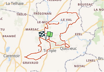

21 km | 24 km-effort


User


FREE GPS app for hiking
 SityTrail
IGN / Geographical institutes
SityTrail World
The world is yours!
Trail Walking of 27 km to be discovered at Brittany, Morbihan, Carentoir. This trail is proposed by vincent35.
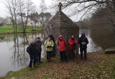
Faite le 17.01.2020, zone inondée, terrain très humide. Parcours en bord de rivières et petits bois.


Cycle

Walking

Cycle

Walking
Walking

Mountain bike
Mountain bike

Equestrian