Trail Walking Eulmont - Eulmont, Bouxières aux Chênes - Photo

Eulmont, Bouxières aux Chênes

© OpenStreetMap contributors
Length
Length
9.9 km
Max alt
Max alt
413 m
Uphill gradient
Uphill gradient
270 m
Km-Effort
Km-Effort  
13.5 km
Min alt
Min alt
238 m
Downhill gradient
Downhill gradient
271 m
Boucle
Boucle
Yes
Creation date :
2014-12-10 00:00:00.0
Updated on :
2014-12-10 00:00:00.0

(0 Reviews)

Walking
Walking
2h22
Difficulty : Easy

Scan this QR Code to open this trail in the SityTrail application

FREE GPS app for hiking

Logo SityTrail SityTrail

IGN / Geographical institutes

Download SityTrail from the App Store Download SityTrail from Google Play

Logo SityTrail SityTrail World

The world is yours!

Download SityTrail from the App Store Download SityTrail from Google Play Download SityTrail on Huawei AppGallery

About

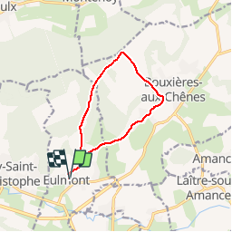
Trail Walking of 9.9 km to be discovered at Grand Est, Meurthe-et-Moselle, Eulmont. This trail is proposed by joelclaudel.

Description

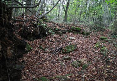
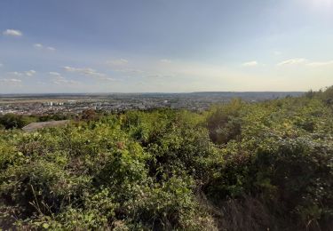
Départ de la rue de Nancy à Eulmont, montée dans le village, puis au plateau Le Grand Cugnot, la Croix Julien), descente sur Bouxières aux Chênes, Moulin, Blanzey, le Prieuré et retour à Eulmont

Elevation profile

Positioning

Country:
France
Region :
Grand Est
Department/Province :
Meurthe-et-Moselle
Municipality :
Eulmont
Location:
Unknown
Start:(UTM)
295943 ; 5403282 (32U) N.

Trails nearby

Trail On foot Champigneulles - Circuit du Val Saint-Barthélémy - Photo
On foot
PRO

On foot

Easy
Champigneulles, Grand Est, Meurthe-et-Moselle, France
7 km | 8.6 km-effort
1h 57min
Yes
Trail On foot Agincourt - Circuit M - Photo
On foot
PRO

On foot

Easy
Agincourt, Grand Est, Meurthe-et-Moselle, France
13.3 km | 17.8 km-effort
4h 3min
No
Trail On foot Lay-Saint-Christophe - Circuit L - Photo
On foot
PRO

On foot

Easy
Lay-Saint-Christophe, Grand Est, Meurthe-et-Moselle, France
14.7 km | 18.5 km-effort
4h 11min
Yes
Trail On foot Champigneulles - Circuit du Vallum de la Fourasse - Photo
On foot
PRO

On foot

Easy
Champigneulles, Grand Est, Meurthe-et-Moselle, France
3.3 km | 4.9 km-effort
1h 6min
Yes
Trail On foot Bouxières-aux-Dames - Circuit moyenne ceinture - Photo
On foot
PRO

On foot

Easy
Bouxières-aux-Dames, Grand Est, Meurthe-et-Moselle, France
3.8 km | 5.3 km-effort
1h 12min
Yes
Trail Walking Eulmont - 2020-12-11_18h42m13_Eulmont_La tour du Crany_10kms - Photo
Walking
Marin B

Walking

Difficult
(1)
Eulmont, Grand Est, Meurthe-et-Moselle, France
9.6 km | 12.6 km-effort
2h 51min
Yes
Trail Walking Dommartemont - Dommartemont  - Photo
Walking
JJG54

Walking

Medium
Dommartemont, Grand Est, Meurthe-et-Moselle, France
29 km | 34 km-effort
3h 5min
No
Trail Hybrid bike Seichamps - Tonnoy - Photo
Hybrid bike
agranier54

Hybrid bike

Medium
(1)
Seichamps, Grand Est, Meurthe-et-Moselle, France
54 km | 61 km-effort
3h 42min
Yes
Trail Walking Bouxières-aux-Chênes - tour crany 29/5/2019 - Photo
Walking
Morel54

Walking

Very easy
(1)
Bouxières-aux-Chênes, Grand Est, Meurthe-et-Moselle, France
11.1 km | 14 km-effort
3h 42min
Yes


Close
My subscriptions