Trail Walking Saint-Michel-le-Cloucq - St Michel le Cloud - Photo
© OpenStreetMap contributors
Length
Length
11.4 km
Max alt
Max alt
107 m
Uphill gradient
Uphill gradient
237 m
Km-Effort
Km-Effort  
14.5 km
Min alt
Min alt
36 m
Downhill gradient
Downhill gradient
239 m
Boucle
Boucle
Yes
Creation date :
2014-12-10 00:00:00.0
Updated on :
2014-12-10 00:00:00.0

(1 Reviews)

Walking
Walking
2h36
Difficulty : Easy

Scan this QR Code to open this trail in the SityTrail application

FREE GPS app for hiking

Logo SityTrail SityTrail

IGN / Geographical institutes

Download SityTrail from the App Store Download SityTrail from Google Play

Logo SityTrail SityTrail World

The world is yours!

Download SityTrail from the App Store Download SityTrail from Google Play Download SityTrail on Huawei AppGallery

About

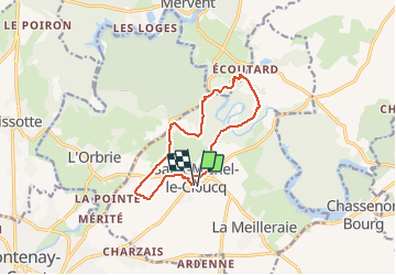
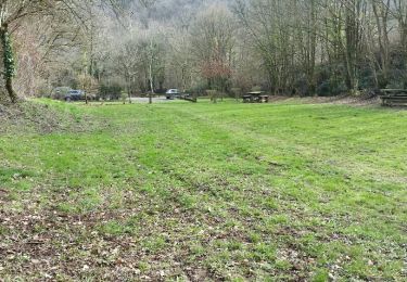
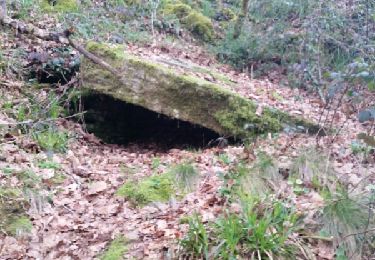
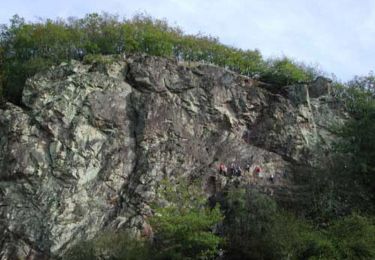
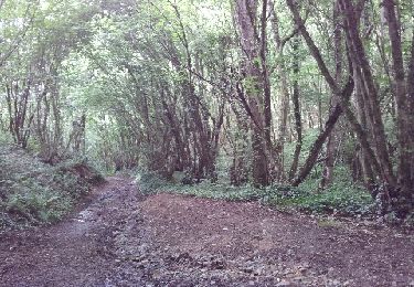
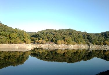
Trail Walking of 11.4 km to be discovered at Pays de la Loire, Vendée, Saint-Michel-le-Cloucq. This trail is proposed by meunier.ph..

Elevation profile

Positioning

Country:
France
Region :
Pays de la Loire
Department/Province :
Vendée
Municipality :
Saint-Michel-le-Cloucq
Location:
Unknown
Start:(UTM)
672572 ; 5150227 (30T) N.

Comments

Please log in to post a review or rate the element


Trails nearby

Trail Walking L'Orbrie - Boucle Mervent  - Photo
Walking
RayFab

Walking

Difficult
L'Orbrie, Pays de la Loire, Vendée, France
12.1 km | 15.4 km-effort
3h 30min
Yes
Trail Walking Pissotte - Lac de Mervent - Gd tour depuis Pissotte  - Photo
Walking
meunier.ph.

Walking

Medium
Pissotte, Pays de la Loire, Vendée, France
26 km | 33 km-effort
5h 15min
Yes
Trail Walking L'Orbrie - balingue - Photo
Walking
penaud

Walking

Medium
L'Orbrie, Pays de la Loire, Vendée, France
7 km | 8.5 km-effort
5h 32min
Yes
Trail Walking Pissotte - Ph. 2017-02 Pissotte : Barrage et forêt de Mervent - Photo
Walking
meunier.ph.

Walking

Difficult
Pissotte, Pays de la Loire, Vendée, France
12.4 km | 15.8 km-effort
2h 25min
Yes
Trail Walking Pissotte - Grand tour du lac de Mervent 2016-03 - Photo
Walking
meunier.ph.

Walking

Medium
Pissotte, Pays de la Loire, Vendée, France
21 km | 27 km-effort
5h 5min
Yes
Trail Mountain bike Mervent - Boucle de Mervent - Photo
Mountain bike
tracegps

Mountain bike

Very difficult
Mervent, Pays de la Loire, Vendée, France
11.7 km | 15.4 km-effort
1h 19min
Yes
Trail Mountain bike Mervent - Randoguide - Photo
Mountain bike
cagouille79

Mountain bike

Difficult
Mervent, Pays de la Loire, Vendée, France
24 km | 31 km-effort
2h 34min
Yes
Trail Walking Pissotte - Du barrage de Mervent à la Balingue - Pissotte - Photo
Walking
tracegps

Walking

Medium
(1)
Pissotte, Pays de la Loire, Vendée, France
14.9 km | 19.1 km-effort
3h 10min
Yes
Trail Mountain bike Pissotte - Boucle de Saint-Luc - Photo
Mountain bike
tracegps

Mountain bike

Very difficult
Pissotte, Pays de la Loire, Vendée, France
13 km | 15.8 km-effort
1h 30min
Yes


Close
My subscriptions