Trail Walking Castellar - Mont Carpano en boucle - Photo
 boboazur
boboazur

User

© OpenStreetMap contributors
Length
Length
8.1 km
Max alt
Max alt
759 m
Uphill gradient
Uphill gradient
469 m
Km-Effort
Km-Effort  
14.4 km
Min alt
Min alt
324 m
Downhill gradient
Downhill gradient
485 m
Boucle
Boucle
Yes
Creation date :
2014-12-10 00:00:00.0
Updated on :
2014-12-10 00:00:00.0

(1 Reviews)

Walking
Walking
3h18
Difficulty : Medium

Scan this QR Code to open this trail in the SityTrail application

FREE GPS app for hiking

Logo SityTrail SityTrail

IGN / Geographical institutes

Download SityTrail from the App Store Download SityTrail from Google Play

Logo SityTrail SityTrail World

The world is yours!

Download SityTrail from the App Store Download SityTrail from Google Play Download SityTrail on Huawei AppGallery

About

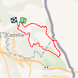
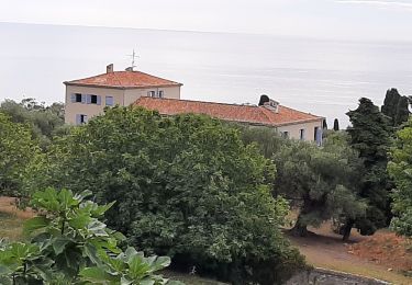
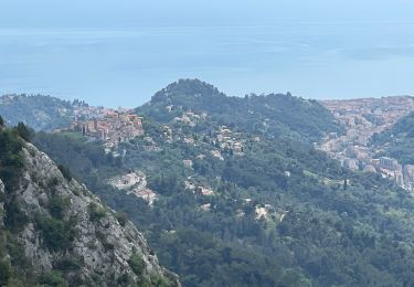
Trail Walking of 8.1 km to be discovered at Provence-Alpes-Côte d'Azur, Maritime Alps, Castellar. This trail is proposed by boboazur.

Description

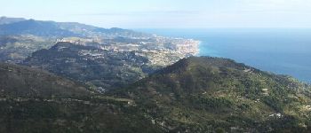
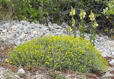
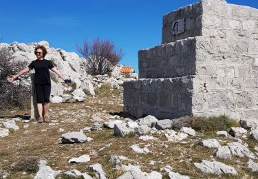
Boucle assez facile au départ de Castellar en direction du Mont Carpano, sur la frontière, d'où l'on bénéficie d'une très belle vue mer et montagne en France et Italie.

Elevation profile

Photos

Points of interest

Point of interest Ventimiglia - Vue sur l'Italie - Photo
boboazur
VENTIMIGLIA 
Point of interest Ventimiglia - Vue Italie - Photo
boboazur
VENTIMIGLIA 

Positioning

Country:
France
Region :
Provence-Alpes-Côte d'Azur
Department/Province :
Maritime Alps
Municipality :
Castellar
Location:
Unknown
Start:(UTM)
379270 ; 4851547 (32T) N.

Comments

Please log in to post a review or rate the element


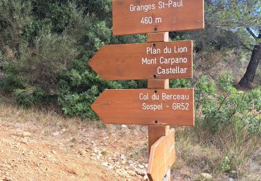
Saute frontiere sympa en poursuivant vers le Castel del Lupo italien.


Trails nearby

Trail On foot Ventimiglia - AM0 - ALPI MARE 0 - Photo
On foot
PRO

On foot

Easy
Ventimiglia, Liguria, Imperia, Italy
9.7 km | 13.8 km-effort
3h 8min
No
Trail Walking Castellar - mont carpano au départ de Castellar - Photo
Walking
56jj

Walking

Medium
Castellar, Provence-Alpes-Côte d'Azur, Maritime Alps, France
7.7 km | 13.9 km-effort
5h 14min
Yes
Trail Walking Castellar - Castellane - roc d'Ormea - Photo
Walking
patsure

Walking

Medium
Castellar, Provence-Alpes-Côte d'Azur, Maritime Alps, France
9.7 km | 20 km-effort
3h 26min
No
Trail Walking Castillon - Castillon : Mt Ours - Photo
Walking
ETMU5496

Walking

Medium
Castillon, Provence-Alpes-Côte d'Azur, Maritime Alps, France
16.7 km | 29 km-effort
4h 22min
Yes
Trail Walking Castellar - gam - Photo
Walking
MauriceJardret

Walking

Very difficult
Castellar, Provence-Alpes-Côte d'Azur, Maritime Alps, France
14.5 km | 28 km-effort
4h 47min
Yes
Trail Walking Menton - tour du Cap Roquebrune Cap Martin - Photo
Walking
piahi

Walking

Difficult
Menton, Provence-Alpes-Côte d'Azur, Maritime Alps, France
10.6 km | 16 km-effort
3h 1min
Yes
Trail Walking Castellar - Castellar : le Grand Mont - Photo
Walking
ETMU5496

Walking

Difficult
Castellar, Provence-Alpes-Côte d'Azur, Maritime Alps, France
18.1 km | 36 km-effort
5h 44min
Yes
Trail On foot Ventimiglia - Sentiero Balcone Mediterraneo T1 - Photo
On foot
PRO

On foot

Easy
Ventimiglia, Liguria, Imperia, Italy
8.3 km | 14.9 km-effort
3h 23min
No
Trail Walking Castillon - Du col de Castillon pour la crête du Mt Razet - Photo
Walking
GrouGary

Walking

Medium
Castillon, Provence-Alpes-Côte d'Azur, Maritime Alps, France
8.1 km | 15.7 km-effort
3h 13min
Yes


Close
My subscriptions