


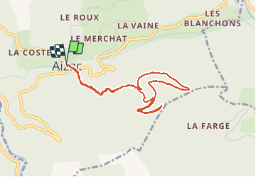

14.1 km | 24 km-effort


User


FREE GPS app for hiking
 SityTrail
IGN / Geographical institutes
SityTrail World
The world is yours!
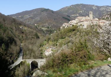
Trail Walking of 4.5 km to be discovered at Auvergne-Rhône-Alpes, Ardèche, Aizac. This trail is proposed by mikaou.t.
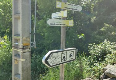
Au départ, se garer sur la parking du col. Partir complètement à gauche de ce parking en passant devant un bâtiment qui sera à votre droite.
Attention ! on voit le point 8 du circuit avant de voir le point 6 ! En fait, le 8 se trouve à l'intersection du sentier de descente qui coupe le circuit au retour et il est en pente assez raide, mais pas trop tout de même.
Walking

Walking
Walking

Walking
Walking
Walking
Walking
Walking
Walking
chemin ravagé par les forestiers à certains endroits