


HAUT KOENIGSBOURG

Francis057
User

Length
10.9 km

Max alt
724 m

Uphill gradient
536 m
Km-Effort
18.1 km

Min alt
251 m

Downhill gradient
537 m
Boucle
Yes
Creation date :
2020-02-23 12:05:30.546
Updated on :
2020-02-23 12:09:10.965
3h41
Difficulty : Difficult

FREE GPS app for hiking
 SityTrail
IGN / Geographical institutes
SityTrail Plus
The world is yours!
About
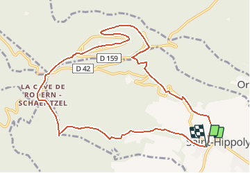
Trail Walking of 10.9 km to be discovered at Grand Est, Haut-Rhin, Saint-Hippolyte. This trail is proposed by Francis057.
Description
Départ du parking à la sortie de Saint Hippolyte sur la route qui va vers le château du Haut-Koenigsbourg
Positioning
Country:
France
Region :
Grand Est
Department/Province :
Haut-Rhin
Municipality :
Saint-Hippolyte
Location:
Unknown
Start:(Dec)
Start:(UTM)
378640 ; 5343364 (32U) N.
Comments