![](/images/other/stat-length.png)
![Trail Walking Durbuy - Sur les dessus de Bomal - Photo](https://media.geolcdn.com/t/1900/400/ext.pjpeg?maxdim=2&url=https%3A%2F%2Fmedia.geolcdn.com%2Ff%2F95859345-d2d2-447d-9601-6791094bfa98.jpg)
Sur les dessus de Bomal
francineposkin
User
![Length](/images/other/stat-length.png)
Length
6.7 km
![Max alt](https://static1.geolcdn.com/siteimages/upload/files/1508320355ic_sort_altitude_max_24dp.png)
Max alt
286 m
![Uphill gradient](https://static1.geolcdn.com/siteimages/upload/files/1508320355ic_sort_den_pos_24dp.png)
Uphill gradient
172 m
![Km-Effort](/images/other/stat-length.png)
Km-Effort
9 km
![Min alt](https://static1.geolcdn.com/siteimages/upload/files/1508320355ic_sort_altitude_min_24dp.png)
Min alt
159 m
![Downhill gradient](https://static1.geolcdn.com/siteimages/upload/files/1508320355ic_sort_den_neg_24dp.png)
Downhill gradient
173 m
![Boucle](https://static1.geolcdn.com/siteimages/upload/files/16400158638029165_repeat_loop_refresh_sync_direction_icon.png)
Boucle
Yes
Creation date :
2020-03-05 08:28:28.917
Updated on :
2020-03-08 15:38:35.788
![Walking](https://static1.geolcdn.com/sitytour/trail-icons/101.png)
1h41
Difficulty : Easy
![Scan this QR Code to open this trail in the SityTrail application](https://capi.geolives.com/qq0zvz2zws4bq2lad0pu/sitytour/trails/2354324/qr.png?size=200)
FREE GPS app for hiking
About
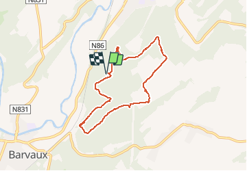
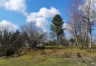
Trail Walking of 6.7 km to be discovered at Wallonia, Luxembourg, Durbuy. This trail is proposed by francineposkin.
Description
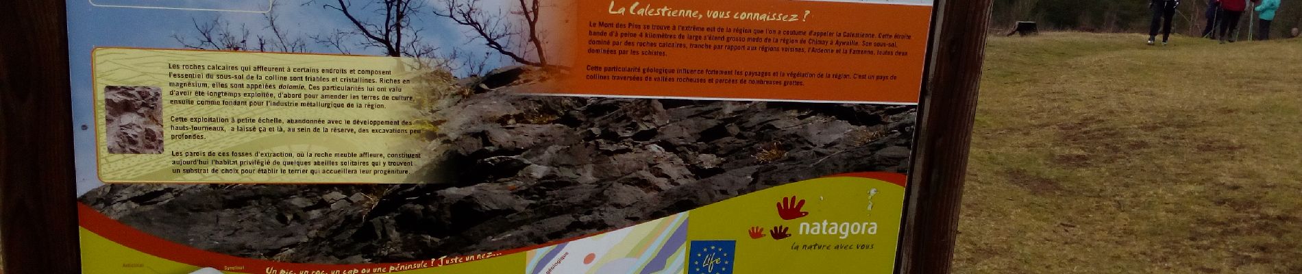
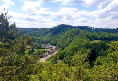
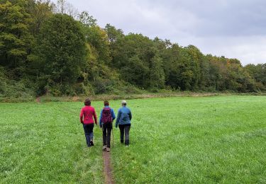
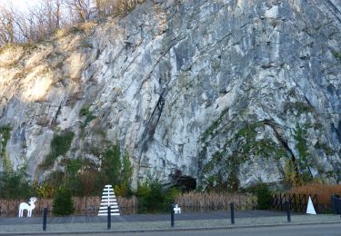
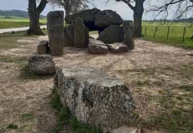
Petite promenade avec de très beaux panoramas. Passage par une réserve naturelle. Une pente un peu difficile . Parking aisé près du domaine de vacances "le mont des pins". Uniquement des sentiers sauf un peu plus de 200 mètres sur une très petite route.
Positioning
Country:
Belgium
Region :
Wallonia
Department/Province :
Luxembourg
Municipality :
Durbuy
Location:
Bomal
Start:(Dec)
Start:(UTM)
678960 ; 5581835 (31U) N.
Comments
Trails nearby
![Trail Walking Durbuy - RB-Lu-01 - Un petit bout de Condroz - Photo](https://media.geolcdn.com/t/375/260/ext.jpg?maxdim=2&url=https%3A%2F%2Fservices.sitytrail.com%2FGeolivesWS%2FDownloadMedia.ashx%3FTrailID%3D179610%26Media%3Dbae66ec4-955f-4295-8f2d-e1b21fcea213.jpg)
![Walking Walking](https://static1.geolcdn.com/sitytour/trail-icons/101.png)
RB-Lu-01 - Un petit bout de Condroz
Walking
Difficult
(5)
Durbuy,
Wallonia,
Luxembourg,
Belgium
![](/images/other/stat-length.png)
24 km | 30 km-effort
6h 27min
![](https://static1.geolcdn.com/siteimages/upload/files/16400158638029165_repeat_loop_refresh_sync_direction_icon.png)
Yes
![Trail Walking Durbuy - RF-Lu-02 - Variante Ravel - Au fils de l'Ourthe : Barvaux - Photo](https://media.geolcdn.com/t/375/260/ext.jpg?maxdim=2&url=https%3A%2F%2Fstatic1.geolcdn.com%2Fsiteimages%2Fupload%2Ffiles%2F1553511878bg_sport_marche.png)
![Walking Walking](https://static1.geolcdn.com/sitytour/trail-icons/101.png)
RF-Lu-02 - Variante Ravel - Au fils de l'Ourthe : Barvaux
Walking
Very easy
(6)
Durbuy,
Wallonia,
Luxembourg,
Belgium
![](/images/other/stat-length.png)
10.5 km | 13.1 km-effort
2h 45min
![](https://static1.geolcdn.com/siteimages/upload/files/16400158638029165_repeat_loop_refresh_sync_direction_icon.png)
Yes
![Trail Walking Durbuy - RF-Lu-01 - De dolmens en menhirs autour de Wéris - Photo](https://media.geolcdn.com/t/375/260/ext.jpg?maxdim=2&url=https%3A%2F%2Fstatic1.geolcdn.com%2Fsiteimages%2Fupload%2Ffiles%2F1553511878bg_sport_marche.png)
![Walking Walking](https://static1.geolcdn.com/sitytour/trail-icons/101.png)
RF-Lu-01 - De dolmens en menhirs autour de Wéris
Walking
Very easy
(7)
Durbuy,
Wallonia,
Luxembourg,
Belgium
![](/images/other/stat-length.png)
12.7 km | 16.5 km-effort
3h 32min
![](https://static1.geolcdn.com/siteimages/upload/files/16400158638029165_repeat_loop_refresh_sync_direction_icon.png)
Yes
![Trail Walking Durbuy - Balade à Bomal sur Ourthe - Photo](https://media.geolcdn.com/t/375/260/ext.jpg?maxdim=2&url=https%3A%2F%2Fmedia.geolcdn.com%2Ff%2F5741dd62-7ff1-40d2-b9aa-0e0aed97da9a.jpg)
![Walking Walking](https://static1.geolcdn.com/sitytour/trail-icons/101.png)
Balade à Bomal sur Ourthe
Walking
Easy
(2)
Durbuy,
Wallonia,
Luxembourg,
Belgium
![](/images/other/stat-length.png)
4.4 km | 5.9 km-effort
1h 20min
![](https://static1.geolcdn.com/siteimages/upload/files/16400158638029165_repeat_loop_refresh_sync_direction_icon.png)
Yes
![Trail Cycle Durbuy - À vélo, autour de Durbuy - Photo](https://media.geolcdn.com/t/375/260/ext.jpg?maxdim=2&url=https%3A%2F%2Fmedia.geolcdn.com%2Ff%2F0cd5bc92-78b0-4b7d-8ab6-58af53446b64.jpg)
![Cycle Cycle](https://static1.geolcdn.com/sitytour/trail-icons/200.png)
À vélo, autour de Durbuy
Cycle
Very easy
(2)
Durbuy,
Wallonia,
Luxembourg,
Belgium
![](/images/other/stat-length.png)
39 km | 45 km-effort
Unknown
![](https://static1.geolcdn.com/siteimages/upload/files/16400158638029165_repeat_loop_refresh_sync_direction_icon.png)
Yes
![Trail Walking Ferrières - GG-Lu-15_Sy - Barvaux - Photo](https://media.geolcdn.com/t/375/260/ext.jpg?maxdim=2&url=https%3A%2F%2Fmedia.geolcdn.com%2Ff%2F4cf6fb9a-77d5-4c51-bb72-4b6ca6a27202.jpg)
![Walking Walking](https://static1.geolcdn.com/sitytour/trail-icons/101.png)
GG-Lu-15_Sy - Barvaux
Walking
Very difficult
(1)
Ferrières,
Wallonia,
Liège,
Belgium
![](/images/other/stat-length.png)
18.9 km | 26 km-effort
5h 58min
![](https://static1.geolcdn.com/siteimages/upload/files/16400158638029165_repeat_loop_refresh_sync_direction_icon.png)
No
![Trail Walking Durbuy - Autour de Tohogne (Durbuy) - Photo](https://media.geolcdn.com/t/375/260/ext.jpg?maxdim=2&url=https%3A%2F%2Fmedia.geolcdn.com%2Ff%2F2a8689fc-6e11-44ce-8f89-67705d1757ba.jpg)
![Walking Walking](https://static1.geolcdn.com/sitytour/trail-icons/101.png)
Autour de Tohogne (Durbuy)
Walking
Medium
(1)
Durbuy,
Wallonia,
Luxembourg,
Belgium
![](/images/other/stat-length.png)
15.7 km | 19.7 km-effort
3h 42min
![](https://static1.geolcdn.com/siteimages/upload/files/16400158638029165_repeat_loop_refresh_sync_direction_icon.png)
Yes
![Trail Walking Durbuy - GG2-Lu-36_Bomal-Marloie (2021-11-04) - Photo](https://media.geolcdn.com/t/375/260/ext.jpg?maxdim=2&url=https%3A%2F%2Fmedia.geolcdn.com%2Ff%2F17057bf6-1de7-415b-afc1-091c87ef5e6e.JPG)
![Walking Walking](https://static1.geolcdn.com/sitytour/trail-icons/101.png)
GG2-Lu-36_Bomal-Marloie (2021-11-04)
Walking
Medium
(2)
Durbuy,
Wallonia,
Luxembourg,
Belgium
![](/images/other/stat-length.png)
43 km | 52 km-effort
11h 51min
![](https://static1.geolcdn.com/siteimages/upload/files/16400158638029165_repeat_loop_refresh_sync_direction_icon.png)
No
![Trail Walking Durbuy - entre le menhir Pire Hena et le dolmen de Weris ... wouai... - Photo](https://media.geolcdn.com/t/375/260/ext.jpg?maxdim=2&url=https%3A%2F%2Fmedia.geolcdn.com%2Ff%2F55715ad5-9df7-48ff-88d3-eb1d3370cd88.jpg)
![Walking Walking](https://static1.geolcdn.com/sitytour/trail-icons/101.png)
entre le menhir Pire Hena et le dolmen de Weris ... wouai...
Walking
Very easy
(1)
Durbuy,
Wallonia,
Luxembourg,
Belgium
![](/images/other/stat-length.png)
6 km | 7.9 km-effort
2h 0min
![](https://static1.geolcdn.com/siteimages/upload/files/16400158638029165_repeat_loop_refresh_sync_direction_icon.png)
Yes
Très jolie ballade avec des panoramas superbes. Possibilité de raccourcir un peu la ballade en prenant le petit chemin lorsque vous arrivez à la route. 2 grosses montées dont une au début et une à la fin.