Trail Walking Échiré - Coudray-Salbart (6km) - Photo

Coudray-Salbart (6km)

 olaze
olaze

User

© OpenStreetMap contributors
Length
Length
5.8 km
Max alt
Max alt
73 m
Uphill gradient
Uphill gradient
101 m
Km-Effort
Km-Effort  
7.2 km
Min alt
Min alt
30 m
Downhill gradient
Downhill gradient
104 m
Boucle
Boucle
Yes
Creation date :
2014-12-10 00:00:00.0
Updated on :
2014-12-10 00:00:00.0

(0 Reviews)

Walking
Walking
2h04
Difficulty : Medium

Scan this QR Code to open this trail in the SityTrail application

FREE GPS app for hiking

Logo SityTrail SityTrail

IGN / Geographical institutes

Download SityTrail from the App Store Download SityTrail from Google Play

Logo SityTrail SityTrail World

The world is yours!

Download SityTrail from the App Store Download SityTrail from Google Play Download SityTrail on Huawei AppGallery

About

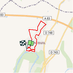
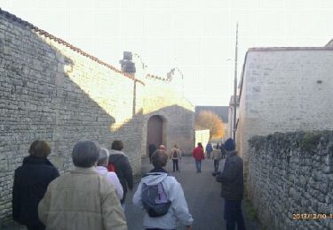
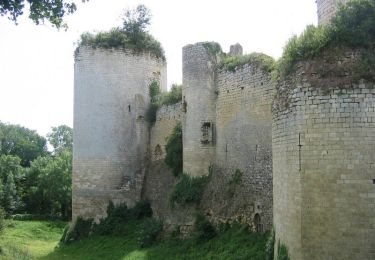
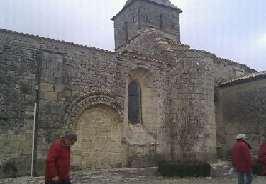
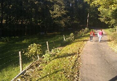
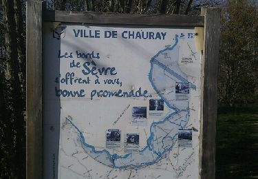
Trail Walking of 5.8 km to be discovered at New Aquitaine, Deux-Sèvres, Échiré. This trail is proposed by olaze.

Description

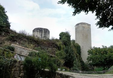
Randonnée autour du chateau Coudray-Salbart (Ternanteuil).
Bonnes pentes . (Ne pas faire par pluie, chemins parfois inondés).Club rando Bessines.

Elevation profile

Photos

Positioning

Country:
France
Region :
New Aquitaine
Department/Province :
Deux-Sèvres
Municipality :
Échiré
Location:
Unknown
Start:(UTM)
697708 ; 5142508 (30T) N.

Trails nearby

Trail Walking Échiré - Echiré: balade des 3 châteaux  - Photo
Walking
jlrayon

Walking

Medium
Échiré, New Aquitaine, Deux-Sèvres, France
6.5 km | 7.2 km-effort
2h 41min
Yes
Trail Electric bike Sciecq - Sciecq  ( tour) - Photo
Electric bike
olaze

Electric bike

Very easy
Sciecq, New Aquitaine, Deux-Sèvres, France
11.1 km | 12 km-effort
58min
Yes
Trail Walking Échiré - 2016-10-31 Échiré Ternanteuil Échiré  - Photo
Walking
cagouille79

Walking

Easy
Échiré, New Aquitaine, Deux-Sèvres, France
11.9 km | 13.4 km-effort
2h 55min
Yes
Trail Walking Saint-Maxire - St Maxire  - Photo
Walking
olaze

Walking

Easy
Saint-Maxire, New Aquitaine, Deux-Sèvres, France
8 km | 9.4 km-effort
2h 6min
Yes
Trail Walking Échiré - Mélusine au bord de la Sèvre - Echiré - Photo
Walking
tracegps

Walking

Medium
Échiré, New Aquitaine, Deux-Sèvres, France
11.6 km | 13.1 km-effort
2h 49min
Yes
Trail Walking Sciecq - Sciecq - Photo
Walking
olaze

Walking

Medium
Sciecq, New Aquitaine, Deux-Sèvres, France
6.9 km | 8.3 km-effort
1h 47min
Yes
Trail Walking Sainte-Ouenne - St Ouenne - Photo
Walking
olaze

Walking

Medium
Sainte-Ouenne, New Aquitaine, Deux-Sèvres, France
10.2 km | 12.3 km-effort
2h 40min
Yes
Trail Walking Chauray - Chauray - Photo
Walking
olaze

Walking

Easy
Chauray, New Aquitaine, Deux-Sèvres, France
8.7 km | 9.6 km-effort
2h 7min
Yes
Trail Walking Sciecq - Sciecq (vallée de Périgny) - Photo
Walking
olaze

Walking

Medium
Sciecq, New Aquitaine, Deux-Sèvres, France
8.5 km | 9.7 km-effort
2h 8min
Yes


Close
My subscriptions