


Cette de Rougnouse

claude nier
User
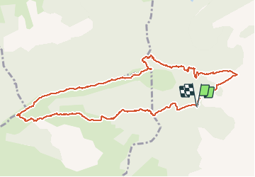

Length
12 km

Max alt
1474 m

Uphill gradient
522 m
Km-Effort
18.9 km

Min alt
1046 m

Downhill gradient
521 m
Boucle
Yes
Creation date :
2020-03-16 09:23:20.958
Updated on :
2020-03-16 17:53:19.096
5h36
Difficulty : Medium

FREE GPS app for hiking
 SityTrail
IGN / Geographical institutes
SityTrail Plus
The world is yours!
About
Trail Walking of 12 km to be discovered at Provence-Alpes-Côte d'Azur, Hautes-Alpes, Val-Buëch-Méouge. This trail is proposed by claude nier.
Description
belle rando..
beau panorama...belle journee
Positioning
Country:
France
Region :
Provence-Alpes-Côte d'Azur
Department/Province :
Hautes-Alpes
Municipality :
Val-Buëch-Méouge
Location:
Ribiers
Start:(Dec)
Start:(UTM)
723812 ; 4901194 (31T) N.
Comments