


Rocher de Pierre Impie par le col de St Pensier

claude nier
User
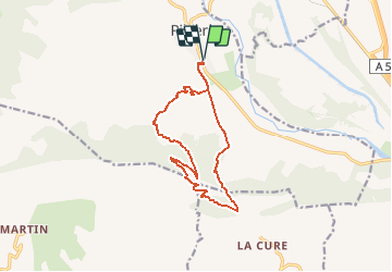

Length
13.7 km

Max alt
986 m

Uphill gradient
544 m
Km-Effort
21 km

Min alt
509 m

Downhill gradient
544 m
Boucle
Yes
Creation date :
2020-04-21 18:07:36.362
Updated on :
2020-04-21 18:09:35.177
--
Difficulty : Medium

FREE GPS app for hiking
 SityTrail
IGN / Geographical institutes
SityTrail Plus
The world is yours!
About
Trail On foot of 13.7 km to be discovered at Provence-Alpes-Côte d'Azur, Hautes-Alpes, Val-Buëch-Méouge. This trail is proposed by claude nier.
Description
tres belle boucle...a decouvrir
Positioning
Country:
France
Region :
Provence-Alpes-Côte d'Azur
Department/Province :
Hautes-Alpes
Municipality :
Val-Buëch-Méouge
Location:
Unknown
Start:(Dec)
Start:(UTM)
728537 ; 4900698 (31T) N.
Comments