


Col de la Mairie depart Ribiers

claude nier
User
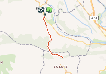

Length
11.2 km

Max alt
744 m

Uphill gradient
281 m
Km-Effort
15 km

Min alt
510 m

Downhill gradient
281 m
Boucle
Yes
Creation date :
2020-05-16 11:23:23.133
Updated on :
2020-05-16 14:49:10.523
3h25
Difficulty : Easy

FREE GPS app for hiking
 SityTrail
IGN / Geographical institutes
SityTrail Plus
The world is yours!
About
Trail Walking of 11.2 km to be discovered at Provence-Alpes-Côte d'Azur, Hautes-Alpes, Val-Buëch-Méouge. This trail is proposed by claude nier.
Description
belle rando..chemin bien balise
Positioning
Country:
France
Region :
Provence-Alpes-Côte d'Azur
Department/Province :
Hautes-Alpes
Municipality :
Val-Buëch-Méouge
Location:
Unknown
Start:(Dec)
Start:(UTM)
728545 ; 4900687 (31T) N.
Comments