Trail Mountain bike Velaux - 2e sortie  - Photo
© OpenStreetMap contributors
Length
Length
12.1 km
Max alt
Max alt
178 m
Uphill gradient
Uphill gradient
175 m
Km-Effort
Km-Effort  
14.4 km
Min alt
Min alt
61 m
Downhill gradient
Downhill gradient
175 m
Boucle
Boucle
Yes
Creation date :
2020-05-21 07:10:44.14
Updated on :
2020-05-27 13:02:42.836

(0 Reviews)

Mountain bike
Mountain bike
2h11
Difficulty : Medium

Scan this QR Code to open this trail in the SityTrail application

FREE GPS app for hiking

Logo SityTrail SityTrail

IGN / Geographical institutes

Download SityTrail from the App Store Download SityTrail from Google Play

Logo SityTrail SityTrail World

The world is yours!

Download SityTrail from the App Store Download SityTrail from Google Play Download SityTrail on Huawei AppGallery

About

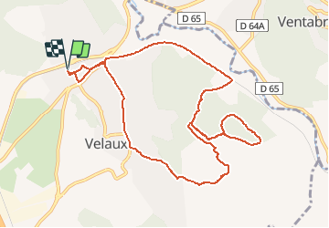
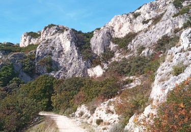
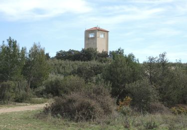
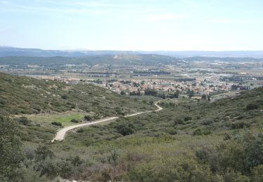
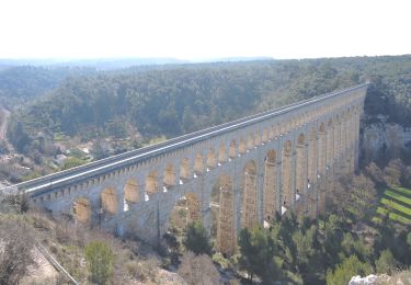
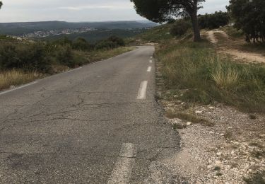
Trail Mountain bike of 12.1 km to be discovered at Provence-Alpes-Côte d'Azur, Bouches-du-Rhône, Velaux. This trail is proposed by Yves Bucci.

Description

St Propice
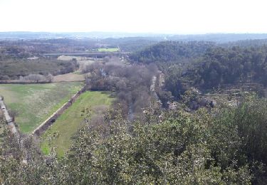
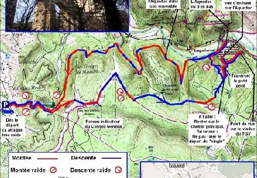
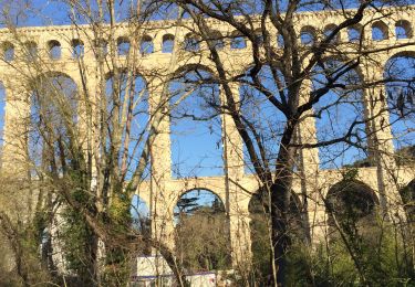
parcours réalisé en   de 2h suite a de nombreux arrêts "découverte".

Elevation profile

Photos

Positioning

Country:
France
Region :
Provence-Alpes-Côte d'Azur
Department/Province :
Bouches-du-Rhône
Municipality :
Velaux
Location:
Unknown
Start:(UTM)
681562 ; 4822327 (31T) N.

Trails nearby

Trail Walking Ventabren - autour de roquefavour  - Photo
Walking
Coryphene

Walking

Very easy
(3)
Ventabren, Provence-Alpes-Côte d'Azur, Bouches-du-Rhône, France
7.7 km | 10.4 km-effort
2h 21min
Yes
Trail Running Velaux - Aqueduc de Roquefavour - Velaux - Photo
Running
tracegps

Running

Medium
(2)
Velaux, Provence-Alpes-Côte d'Azur, Bouches-du-Rhône, France
12.4 km | 17.3 km-effort
1h 19min
Yes
Trail On foot Ventabren - Le Canal de Marseille et l'Aqueduc de Roquefavour - Photo
On foot
Valentin Lelong

On foot

Easy
(1)
Ventabren, Provence-Alpes-Côte d'Azur, Bouches-du-Rhône, France
12.1 km | 14.8 km-effort
3h 21min
Yes
Trail Walking Ventabren - Balade Coudoux - Photo
Walking
maginot

Walking

Easy
Ventabren, Provence-Alpes-Côte d'Azur, Bouches-du-Rhône, France
24 km | 29 km-effort
2h 6min
No
Trail Walking La Fare-les-Oliviers - Castelas Bories - Photo
Walking
sereton

Walking

Easy
La Fare-les-Oliviers, Provence-Alpes-Côte d'Azur, Bouches-du-Rhône, France
10.2 km | 12.9 km-effort
2h 55min
No
Trail Walking La Fare-les-Oliviers - PF-La Fare-les-Oliviers - R - Variante - Photo
Walking
MicDul

Walking

La Fare-les-Oliviers, Provence-Alpes-Côte d'Azur, Bouches-du-Rhône, France
6.6 km | 8.8 km-effort
1h 50min
Yes
Trail Walking La Fare-les-Oliviers - PF-La Fare-les-Oliviers - J - Photo
Walking
MicDul

Walking

Easy
La Fare-les-Oliviers, Provence-Alpes-Côte d'Azur, Bouches-du-Rhône, France
9.5 km | 12.1 km-effort
2h 44min
Yes
Trail Walking Ventabren - Randonnée du 01/12/2023 à 11:11 - Photo
Walking
MicDul

Walking

Easy
Ventabren, Provence-Alpes-Côte d'Azur, Bouches-du-Rhône, France
11.9 km | 14.7 km-effort
4h 30min
Yes
Trail Walking Coudoux - GB LES SENTIERS VERTS  - Photo
Walking
Ghislaine Blanchet

Walking

Medium
(1)
Coudoux, Provence-Alpes-Côte d'Azur, Bouches-du-Rhône, France
6.1 km | 7 km-effort
1h 49min
Yes


Close
My subscriptions