


Saint-Martin-des-Combes Randonnée

amelie14
User
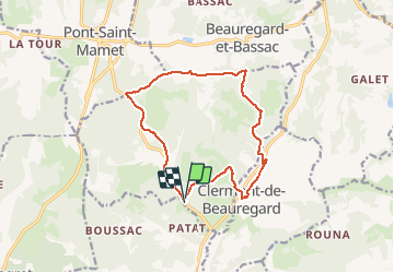

Length
13.9 km

Max alt
199 m

Uphill gradient
252 m
Km-Effort
17.3 km

Min alt
91 m

Downhill gradient
260 m
Boucle
Yes
Creation date :
2020-05-22 16:59:53.526
Updated on :
2020-05-22 17:00:55.255
3h44
Difficulty : Difficult

FREE GPS app for hiking
 SityTrail
IGN / Geographical institutes
SityTrail Plus
The world is yours!
About
Trail Walking of 13.9 km to be discovered at New Aquitaine, Dordogne, Saint-Martin-des-Combes. This trail is proposed by amelie14.
Positioning
Country:
France
Region :
New Aquitaine
Department/Province :
Dordogne
Municipality :
Saint-Martin-des-Combes
Location:
Unknown
Start:(Dec)
Start:(UTM)
312340 ; 4980332 (31T) N.
Comments