


guewenheim de

jacthiry
User
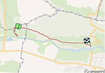

Length
2.2 km

Max alt
370 m

Uphill gradient
30 m
Km-Effort
2.7 km

Min alt
330 m

Downhill gradient
45 m
Boucle
No
Creation date :
2020-05-22 12:53:17.718
Updated on :
2020-05-22 17:28:13.052
34m
Difficulty : Very easy

FREE GPS app for hiking
 SityTrail
IGN / Geographical institutes
SityTrail Plus
The world is yours!
About
Trail Walking of 2.2 km to be discovered at Grand Est, Haut-Rhin, Sentheim. This trail is proposed by jacthiry.
Positioning
Country:
France
Region :
Grand Est
Department/Province :
Haut-Rhin
Municipality :
Sentheim
Location:
Unknown
Start:(Dec)
Start:(UTM)
355212 ; 5291396 (32T) N.
Comments