


La chapelle Saint Etienne de Braguse

chanac les mines
User

Length
6.8 km

Max alt
457 m

Uphill gradient
249 m
Km-Effort
10.1 km

Min alt
287 m

Downhill gradient
249 m
Boucle
Yes
Creation date :
2020-05-27 07:48:22.401
Updated on :
2020-05-27 08:07:56.953
2h30
Difficulty : Medium

FREE GPS app for hiking
 SityTrail
IGN / Geographical institutes
SityTrail Plus
The world is yours!
About
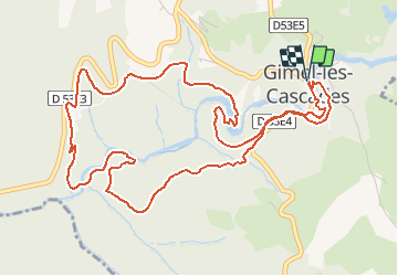
Trail On foot of 6.8 km to be discovered at New Aquitaine, Corrèze, Gimel-les-Cascades. This trail is proposed by chanac les mines.
Description
Sentier un peu escarpé , mais agréable a découvrir , site remarquable a visiter .
Photos

Positioning
Country:
France
Region :
New Aquitaine
Department/Province :
Corrèze
Municipality :
Gimel-les-Cascades
Location:
Unknown
Start:(Dec)
Start:(UTM)
409894 ; 5016897 (31T) N.
Comments