Trail Walking Seillons-Source-d'Argens - Seillons source d'Argens... rocher des abeilles... la bastidasse - Photo

Seillons source d'Argens... rocher des abeilles... la bastidasse

 chrifor
chrifor

User

© OpenStreetMap contributors
Length
Length
13.9 km
Max alt
Max alt
520 m
Uphill gradient
Uphill gradient
231 m
Km-Effort
Km-Effort  
16.9 km
Min alt
Min alt
307 m
Downhill gradient
Downhill gradient
230 m
Boucle
Boucle
Yes
Creation date :
2020-05-26 08:20:19.858
Updated on :
2020-06-04 15:55:13.651

(1 Reviews)

Walking
Walking
3h25
Difficulty : Easy

Scan this QR Code to open this trail in the SityTrail application

FREE GPS app for hiking

Logo SityTrail SityTrail

IGN / Geographical institutes

Download SityTrail from the App Store Download SityTrail from Google Play

Logo SityTrail SityTrail World

The world is yours!

Download SityTrail from the App Store Download SityTrail from Google Play Download SityTrail on Huawei AppGallery

About

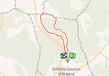
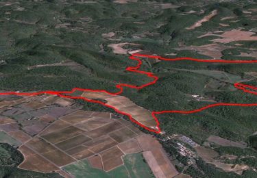
Trail Walking of 13.9 km to be discovered at Provence-Alpes-Côte d'Azur, Var, Seillons-Source-d'Argens. This trail is proposed by chrifor.

Description

Parcourue le 26/05 2020
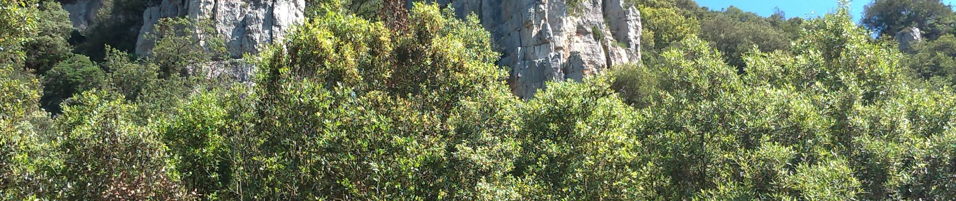
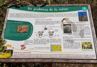
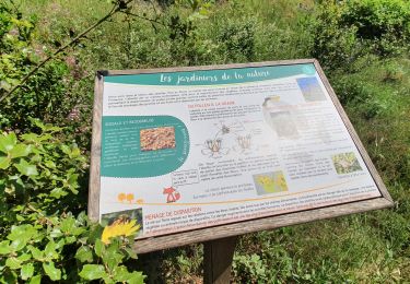
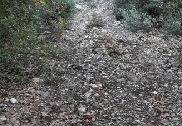
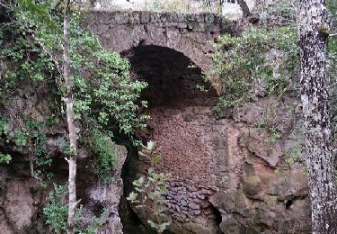
"montée" en sous-bois ombragé sous le Rocher des abeilles, jusqu'au plateau de la Bastidasse, ferme abandonnée. Retour plus dégagé en partie caillouteux.
Parking et départ de la déchèterie de Seillons.

Elevation profile

Photos

Positioning

Country:
France
Region :
Provence-Alpes-Côte d'Azur
Department/Province :
Var
Municipality :
Seillons-Source-d'Argens
Location:
Unknown
Start:(UTM)
733392 ; 4820811 (31T) N.

Comments

Please log in to post a review or rate the element


Un peu monotone.


Trails nearby

Trail sport Brue-Auriac - 2024-03-31_18h55m13_De Vignes en Vignes - Photo
sport
gonzi83

sport

Very easy
(1)
Brue-Auriac, Provence-Alpes-Côte d'Azur, Var, France
10.7 km | 13.7 km-effort
Unknown
Yes
Trail Walking Brue-Auriac - Trace_Brue-Auriac - Photo
Walking
GUIDE
affinetataille

Walking

Easy
Brue-Auriac, Provence-Alpes-Côte d'Azur, Var, France
16.4 km | 21 km-effort
6h 0min
Yes
Trail Walking Seillons-Source-d'Argens - Rocher des abeilles-02-02-2022 - Photo
Walking
Christiancordin

Walking

Medium
Seillons-Source-d'Argens, Provence-Alpes-Côte d'Azur, Var, France
23 km | 30 km-effort
5h 56min
Yes
Trail Walking Seillons-Source-d'Argens - SEILLONS SUR ARGENS - SOURCE DE L'ARGENS - Photo
Walking
jean-marie.parachini

Walking

Medium
Seillons-Source-d'Argens, Provence-Alpes-Côte d'Azur, Var, France
15 km | 20 km-effort
5h 33min
Yes
Trail Walking Seillons-Source-d'Argens - seillons source d
Walking
marchev

Walking

Medium
Seillons-Source-d'Argens, Provence-Alpes-Côte d'Azur, Var, France
13.8 km | 16.8 km-effort
4h 42min
Yes
Trail Walking Seillons-Source-d'Argens - seillon - Photo
Walking
jo-ba

Walking

Easy
(1)
Seillons-Source-d'Argens, Provence-Alpes-Côte d'Azur, Var, France
15.2 km | 19.2 km-effort
5h 18min
Yes
Trail Walking Brue-Auriac - brue auriac - Photo
Walking
marchev

Walking

Very easy
Brue-Auriac, Provence-Alpes-Côte d'Azur, Var, France
13.3 km | 16.4 km-effort
4h 42min
Yes
Trail Walking Seillons-Source-d'Argens - Puits de Dagnié par le Devençon de l'Inarden - Photo
Walking
ARPF2

Walking

Difficult
Seillons-Source-d'Argens, Provence-Alpes-Côte d'Azur, Var, France
9.9 km | 12.6 km-effort
2h 52min
Yes
Trail Walking Saint-Maximin-la-Sainte-Baume - Jcg 30-01-24  - Photo
Walking
Gessay

Walking

Easy
Saint-Maximin-la-Sainte-Baume, Provence-Alpes-Côte d'Azur, Var, France
3.2 km | 4.3 km-effort
23h 27min
Yes


Close
My subscriptions