


TRK000

JCLUTT
User
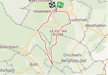

Length
14.6 km

Max alt
591 m

Uphill gradient
391 m
Km-Effort
19.8 km

Min alt
307 m

Downhill gradient
380 m
Boucle
Yes
Creation date :
2020-05-27 18:51:50.533
Updated on :
2021-05-26 07:52:21.349
4h12
Difficulty : Medium

FREE GPS app for hiking
 SityTrail
IGN / Geographical institutes
SityTrail Plus
The world is yours!
About
Trail Walking of 14.6 km to be discovered at Grand Est, Haut-Rhin, Soultzmatt. This trail is proposed by JCLUTT.
Positioning
Country:
France
Region :
Grand Est
Department/Province :
Haut-Rhin
Municipality :
Soultzmatt
Location:
Unknown
Start:(Dec)
Start:(UTM)
366731 ; 5314341 (32T) N.
Comments