Trail Walking Cormery - Cormery - Esvres - GR 46 PR 2 - 16km 150m 3h25 - 2020 06 01 - Photo

Cormery - Esvres - GR 46 PR 2 - 16km 150m 3h25 - 2020 06 01

 Orcal37
Orcal37

User

© OpenStreetMap contributors
Length
Length
16 km
Max alt
Max alt
98 m
Uphill gradient
Uphill gradient
151 m
Km-Effort
Km-Effort  
18 km
Min alt
Min alt
57 m
Downhill gradient
Downhill gradient
152 m
Boucle
Boucle
Yes
Creation date :
2020-06-01 12:40:07.051
Updated on :
2020-06-01 18:16:30.67

(0 Reviews)

Walking
Walking
3h25
Difficulty : Easy

Scan this QR Code to open this trail in the SityTrail application

FREE GPS app for hiking

Logo SityTrail SityTrail

IGN / Geographical institutes

Download SityTrail from the App Store Download SityTrail from Google Play

Logo SityTrail SityTrail World

The world is yours!

Download SityTrail from the App Store Download SityTrail from Google Play Download SityTrail on Huawei AppGallery

About

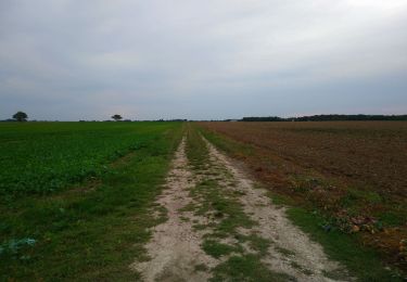
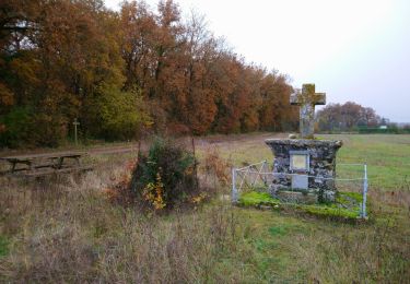
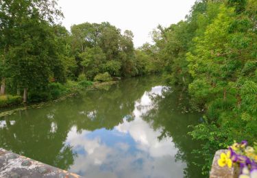
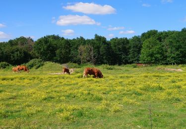
Trail Walking of 16 km to be discovered at Centre-Loire Valley, Indre-et-Loire, Cormery. This trail is proposed by Orcal37.

Description

Cormery - boucle Esvres sur Indre - via GR 46 et PR 2 Esvres - 16km 150m 3h25 - 2020 06 01

Elevation profile

Photos

Positioning

Country:
France
Region :
Centre-Loire Valley
Department/Province :
Indre-et-Loire
Municipality :
Cormery
Location:
Unknown
Start:(UTM)
336172 ; 5237355 (31T) N.

Trails nearby

Trail Walking Esvres - Esvres - Photo
Walking
LEMENIO

Walking

Easy
(2)
Esvres, Centre-Loire Valley, Indre-et-Loire, France
9.3 km | 10.9 km-effort
2h 14min
Yes
Trail Walking Saint-Branchs - Saint-Branchs - les Boissières Chemin du Rail - 8.3km 35m 1h45 - 2023 09 27 - Photo
Walking
Orcal37

Walking

Easy
Saint-Branchs, Centre-Loire Valley, Indre-et-Loire, France
8.3 km | 8.7 km-effort
1h 45min
Yes
Trail Walking Truyes - Truyes - La Croix de l'Apothicaresse - 19.9km 125m 4h20 (25mn) - 2021 11 20 - Photo
Walking
Orcal37

Walking

Easy
Truyes, Centre-Loire Valley, Indre-et-Loire, France
19.9 km | 22 km-effort
4h 20min
Yes
Trail Walking Tauxigny-Saint-Bauld - Malabry - Tauxigny chemin des Moulins - 12.4km 160m 3h00 - 2020 09 07 - Photo
Walking
Orcal37

Walking

Easy
Tauxigny-Saint-Bauld, Centre-Loire Valley, Indre-et-Loire, France
12.4 km | 14.6 km-effort
3h 0min
Yes
Trail Walking Saint-Branchs - la Fontaine - Saint-Branchs - 14.1km 120m 3h10 - 2020 06 24 - Photo
Walking
Orcal37

Walking

Easy
Saint-Branchs, Centre-Loire Valley, Indre-et-Loire, France
14.1 km | 15.7 km-effort
3h 10min
Yes
Trail Walking Courçay - Courçay - Reignac-sur-Indre - 14.1km 145m 3h05 - 2020 06 20 - Photo
Walking
Orcal37

Walking

Easy
Courçay, Centre-Loire Valley, Indre-et-Loire, France
14.1 km | 16.1 km-effort
3h 5min
Yes
Trail Walking Saint-Branchs - Saint-Branchs - Circuit 2 avec variante - 23.3km 130m 5h00 - 2020 05 25 - Photo
Walking
Orcal37

Walking

Easy
Saint-Branchs, Centre-Loire Valley, Indre-et-Loire, France
23 km | 25 km-effort
5h 0min
Yes
Trail Walking Truyes - truyes - Photo
Walking
jeanjean37

Walking

Easy
(1)
Truyes, Centre-Loire Valley, Indre-et-Loire, France
7.4 km | 8.4 km-effort
1h 34min
Yes
Trail Walking Truyes - Truyes (Gâtacier - Courcay) - Cormery - 2016 07 15 - 220m 17,6km - Photo
Walking
Orcal37

Walking

Easy
Truyes, Centre-Loire Valley, Indre-et-Loire, France
17.6 km | 19.8 km-effort
3h 45min
Yes


Close
My subscriptions