« Les évêques » depuis baignes jusqu à mont le bernois

nicolasdresse
User

Length
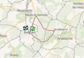
9.7 km

Max alt
414 m

Uphill gradient
230 m
Km-Effort
12.8 km

Min alt
219 m

Downhill gradient
227 m
Boucle
Yes
Creation date :
2020-06-07 14:24:00.0
Updated on :
2020-06-08 06:31:51.855
3h07
Difficulty : Unknown

FREE GPS app for hiking
 SityTrail
IGN / Geographical institutes
SityTrail Plus
The world is yours!
About
Trail Walking of 9.7 km to be discovered at Bourgogne-Franche-Comté, Haute-Saône, Baignes. This trail is proposed by nicolasdresse.
Description
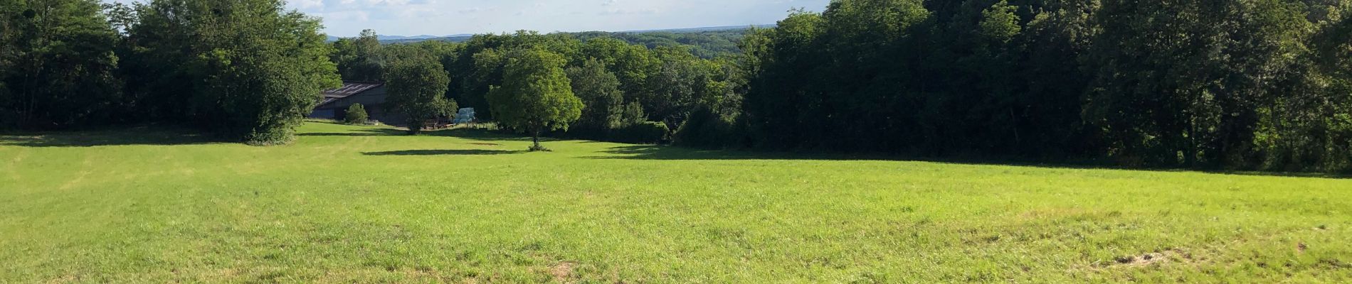
Des forges de baignes jusqu à la superbe maison autonome des évêques ( coup de chapeau à son propriétaire) andelarre, mont le vernois et retour sur baignes.
Belle randonnée en famille
Photos


Positioning
Country:
France
Region :
Bourgogne-Franche-Comté
Department/Province :
Haute-Saône
Municipality :
Baignes
Location:
Unknown
Start:(Dec)
Start:(UTM)
278206 ; 5274445 (32T) N.
Comments