


2020-06-09_14h18m18_Col de Porte Col de L'Autaret.156

Renefrt
User
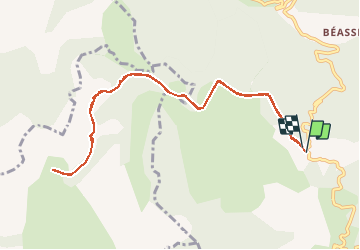

Length
10.8 km

Max alt
1264 m

Uphill gradient
419 m
Km-Effort
16.4 km

Min alt
1054 m

Downhill gradient
417 m
Boucle
Yes
Creation date :
2020-06-09 12:18:18.774
Updated on :
2020-10-02 10:01:04.234
--
Difficulty : Medium

FREE GPS app for hiking
 SityTrail
IGN / Geographical institutes
SityTrail Plus
The world is yours!
About
Trail On foot of 10.8 km to be discovered at Provence-Alpes-Côte d'Azur, Maritime Alps, Lucéram. This trail is proposed by Renefrt.
Positioning
Country:
France
Region :
Provence-Alpes-Côte d'Azur
Department/Province :
Maritime Alps
Municipality :
Lucéram
Location:
Unknown
Start:(Dec)
Start:(UTM)
366174 ; 4862967 (32T) N.
Comments