Trail Walking Monlezun-d'Armagnac - forêt monlezun - Photo
 DuMarsan
DuMarsan

User

© OpenStreetMap contributors
Length
Length
8.5 km
Max alt
Max alt
93 m
Uphill gradient
Uphill gradient
78 m
Km-Effort
Km-Effort  
9.6 km
Min alt
Min alt
73 m
Downhill gradient
Downhill gradient
81 m
Boucle
Boucle
Yes
Creation date :
2014-12-10 00:00:00.0
Updated on :
2014-12-10 00:00:00.0

(0 Reviews)

Walking
Walking
1h43
Difficulty : Very easy

Scan this QR Code to open this trail in the SityTrail application

FREE GPS app for hiking

Logo SityTrail SityTrail

IGN / Geographical institutes

Download SityTrail from the App Store Download SityTrail from Google Play

Logo SityTrail SityTrail World

The world is yours!

Download SityTrail from the App Store Download SityTrail from Google Play Download SityTrail on Huawei AppGallery

About

Trail Walking of 8.5 km to be discovered at Occitania, Gers, Monlezun-d'Armagnac. This trail is proposed by DuMarsan.

Description

Ballade issue du Topoguide "le pays d' armagnac à pied".
Boucle familiale presque entièrement ombragée, très agréable en été.Peut être boueuse en automne ou hiver.
Idéale après un bon repas ou avec des enfants pour leur faire découvrir le plaisir des promenades dans la nature.

Elevation profile

Positioning

Country:
France
Region :
Occitania
Department/Province :
Gers
Municipality :
Monlezun-d'Armagnac
Location:
Unknown
Start:(UTM)
729568 ; 4857702 (30T) N.

Trails nearby

Trail Walking Estang - Estang, circuit n1 + balade en ville  - Photo
Walking
Santblasi

Walking

Easy
Estang, Occitania, Gers, France
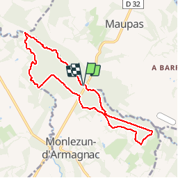
8.7 km | 10.5 km-effort
2h 30min
Yes


Close
My subscriptions