


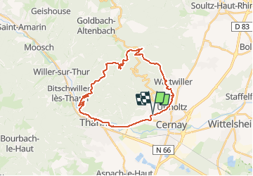
Rocher Albert + Molkenrain

Derrendinger
User

Length
28 km

Max alt
1091 m

Uphill gradient
922 m
Km-Effort
40 km

Min alt
306 m

Downhill gradient
922 m
Boucle
Yes
Creation date :
2020-06-12 10:57:04.0
Updated on :
2020-06-12 14:26:39.183
2h26
Difficulty : Unknown

FREE GPS app for hiking
 SityTrail
IGN / Geographical institutes
SityTrail Plus
The world is yours!
About
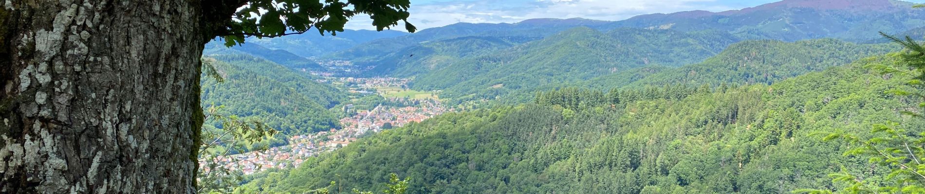
Trail Mountain bike of 28 km to be discovered at Grand Est, Haut-Rhin, Steinbach. This trail is proposed by Derrendinger.
Description
quelques passages difficiles
Photos


Positioning
Country:
France
Region :
Grand Est
Department/Province :
Haut-Rhin
Municipality :
Steinbach
Location:
Unknown
Start:(Dec)
Start:(UTM)
362320 ; 5297462 (32T) N.
Comments