


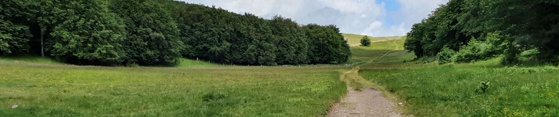
RA Rocher de Chironne

dfluzin
User
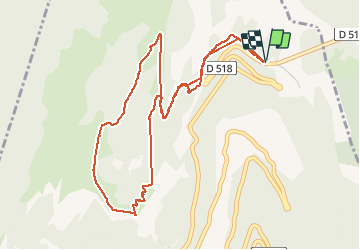

Length
5.8 km

Max alt
1483 m

Uphill gradient
277 m
Km-Effort
9.5 km

Min alt
1238 m

Downhill gradient
282 m
Boucle
Yes
Creation date :
2020-06-17 08:19:40.889
Updated on :
2020-06-17 12:55:46.991
2h47
Difficulty : Easy

FREE GPS app for hiking
 SityTrail
IGN / Geographical institutes
SityTrail Plus
The world is yours!
About
Trail Walking of 5.8 km to be discovered at Auvergne-Rhône-Alpes, Drôme, Chamaloc. This trail is proposed by dfluzin.
Photos


Positioning
Country:
France
Region :
Auvergne-Rhône-Alpes
Department/Province :
Drôme
Municipality :
Chamaloc
Location:
Unknown
Start:(Dec)
Start:(UTM)
689406 ; 4967774 (31T) N.
Comments