


BRAMANS - 73

AndreLACOMBE
User
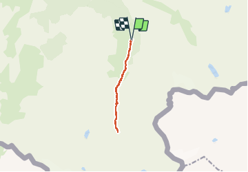

Length
9.3 km

Max alt
2345 m

Uphill gradient
368 m
Km-Effort
14.2 km

Min alt
1980 m

Downhill gradient
367 m
Boucle
Yes
Creation date :
2020-06-19 08:26:57.831
Updated on :
2020-06-19 16:04:57.223
5h32
Difficulty : Medium

FREE GPS app for hiking
 SityTrail
IGN / Geographical institutes
SityTrail Plus
The world is yours!
About
Trail Walking of 9.3 km to be discovered at Auvergne-Rhône-Alpes, Savoy, Val-Cenis. This trail is proposed by AndreLACOMBE.
Description
De Bramans Chef-Lieu, en voiture jusqu'à Maroqua (parking). Sentier jusqu'au refuge d'Ambin et éventuellement lac d'Ambin et/ou Lac Noir.
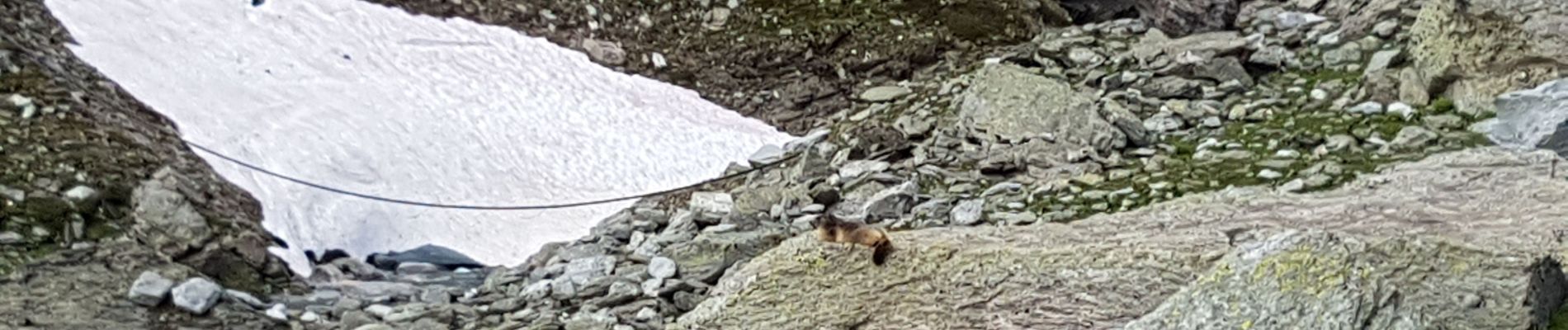
Photos


Positioning
Country:
France
Region :
Auvergne-Rhône-Alpes
Department/Province :
Savoy
Municipality :
Val-Cenis
Location:
Bramans
Start:(Dec)
Start:(UTM)
332880 ; 5005823 (32T) N.
Comments