Trail Walking Congénies - CONGENIES - 12.0Km - 03h20 - Dénivelé 297 m - Photo

CONGENIES - 12.0Km - 03h20 - Dénivelé 297 m

© OpenStreetMap contributors
Length
Length
12 km
Max alt
Max alt
89 m
Uphill gradient
Uphill gradient
127 m
Km-Effort
Km-Effort  
13.7 km
Min alt
Min alt
38 m
Downhill gradient
Downhill gradient
127 m
Boucle
Boucle
Yes
Creation date :
2014-12-10 00:00:00.0
Updated on :
2014-12-10 00:00:00.0

(0 Reviews)

Walking
Walking
3h02
Difficulty : Medium

Scan this QR Code to open this trail in the SityTrail application

FREE GPS app for hiking

Logo SityTrail SityTrail

IGN / Geographical institutes

Download SityTrail from the App Store Download SityTrail from Google Play

Logo SityTrail SityTrail World

The world is yours!

Download SityTrail from the App Store Download SityTrail from Google Play Download SityTrail on Huawei AppGallery

About

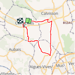
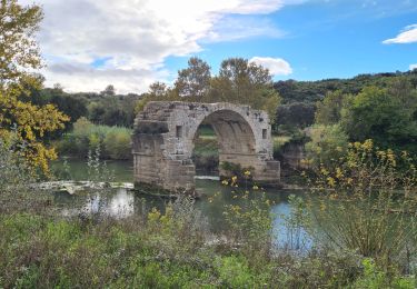
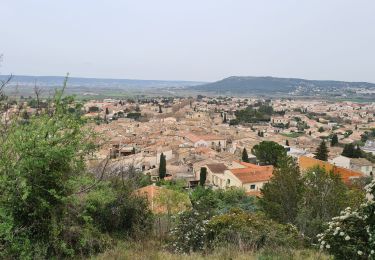
Trail Walking of 12 km to be discovered at Occitania, Gard, Congénies. This trail is proposed by dansmabulle.

Description

CONGENIES
12.0Km - 03h20
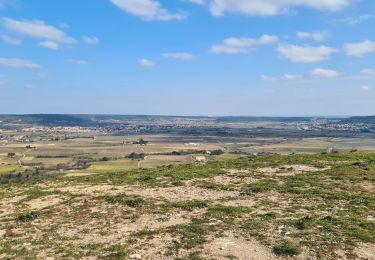
Départ randonnée : Parking au départ de Congéniès au bord de la voie verte près d'un grand bâtiment. Randonnée très facile de 12 km en terrain plat. On circule entre les oliveraies et les jeunes vignes. A ne pas faire après de fortes pluies car chemins "gras". Pas de centre d'intérêt particulier. Possibilité de raccourcir à 10 km au niveau de "la Pierre Plantée".

Elevation profile

Positioning

Country:
France
Region :
Occitania
Department/Province :
Gard
Municipality :
Congénies
Location:
Unknown
Start:(Dec)
Start:(UTM)
593379 ; 4847374 (31T) N.

Trails nearby

Trail Mountain bike Calvisson - Espace VTT-FFC Pays de Sommières n°7 - Les Châteaux du Sommiérois - Photo
Mountain bike
tracegps

Mountain bike

Difficult
(1)
Calvisson, Occitania, Gard, France
42 km | 50 km-effort
3h 30min
Yes
Trail Walking Junas - Entre Junas et Aujargues - Photo
Walking
GUIDE
randotines

Walking

Easy
Junas, Occitania, Gard, France
7.9 km | 9.4 km-effort
2h 2min
Yes
Trail Walking Junas - Aubais  - Photo
Walking
Galoche

Walking

Very easy
Junas, Occitania, Gard, France
6.4 km | 7.8 km-effort
1h 39min
Yes
Trail Walking Congénies - congenies-lemazet-calvisson - Photo
Walking
v.rabot

Walking

Medium
Congénies, Occitania, Gard, France
16.9 km | 21 km-effort
5h 0min
Yes
Trail Walking Aubais - Aubais-junas-moulin_de_corbières - Photo
Walking
v.rabot

Walking

Medium
Aubais, Occitania, Gard, France
15.5 km | 18.3 km-effort
5h 0min
Yes
Trail Walking Villetelle - villetelle  - Photo
Walking
v.rabot

Walking

Easy
Villetelle, Occitania, Hérault, France
6.6 km | 7.9 km-effort
1h 34min
Yes
Trail Walking Aubais - moulin-carriere-gallargues - Photo
Walking
v.rabot

Walking

Easy
Aubais, Occitania, Gard, France
12.5 km | 14.1 km-effort
2h 30min
Yes
Trail Walking Villetelle - Sensei pascal  - Photo
Walking
rio34740

Walking

Medium
Villetelle, Occitania, Hérault, France
17.7 km | 0 m-effort
5h 17min
Yes
Trail Walking Congénies - Congenies-Mazet-Sincans-Calvisson - Photo
Walking
v.rabot

Walking

Medium
Congénies, Occitania, Gard, France
18 km | 23 km-effort
5h 30min
Yes


Close
My subscriptions