Trail Walking Montclus - MONTCLUS - 12.3 Km - 04h00 Heures - Dénivelé 368 m - Photo

MONTCLUS - 12.3 Km - 04h00 Heures - Dénivelé 368 m

© OpenStreetMap contributors
Length
Length
12.3 km
Max alt
Max alt
319 m
Uphill gradient
Uphill gradient
331 m
Km-Effort
Km-Effort  
16.7 km
Min alt
Min alt
85 m
Downhill gradient
Downhill gradient
331 m
Boucle
Boucle
Yes
Creation date :
2014-12-10 00:00:00.0
Updated on :
2014-12-10 00:00:00.0

(0 Reviews)

Walking
Walking
3h33
Difficulty : Medium

Scan this QR Code to open this trail in the SityTrail application

FREE GPS app for hiking

Logo SityTrail SityTrail

IGN / Geographical institutes

Download SityTrail from the App Store Download SityTrail from Google Play

Logo SityTrail SityTrail World

The world is yours!

Download SityTrail from the App Store Download SityTrail from Google Play Download SityTrail on Huawei AppGallery

About

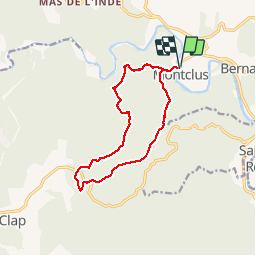
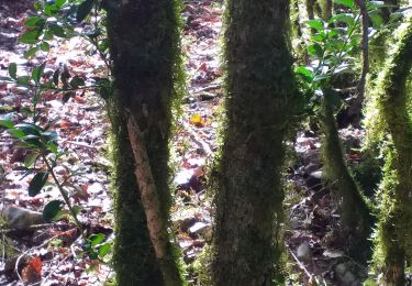
Trail Walking of 12.3 km to be discovered at Occitania, Gard, Montclus. This trail is proposed by dansmabulle.

Description

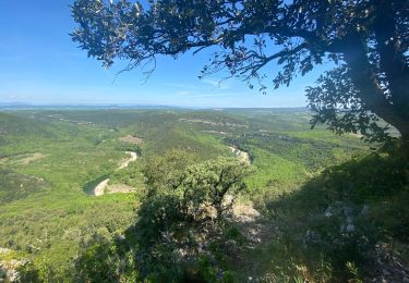
12.3 Km - 04:00 Heures - Dénivelé 368 mètres
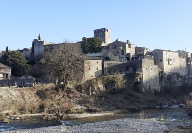
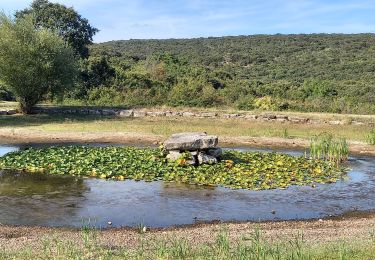
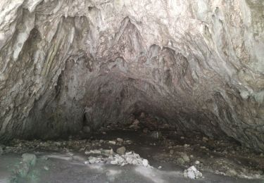
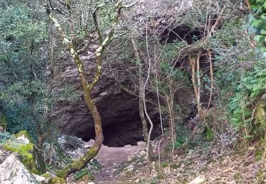
Départ randonnée :  Village de Montclus -Gard 30- départ de Montclus pour une balade de 12,5Km dans la garrigue au nord du village. 330m de dénivelé cumulé, vue imprenable sur la CEZE depuis la dent du Serret, la balade se termine par la visite du village de MONTCLUS. Attention aux crues de la rivière -pont submersible-
Bonne randonnée 

Elevation profile

Positioning

Country:
France
Region :
Occitania
Department/Province :
Gard
Municipality :
Montclus
Location:
Unknown
Start:(UTM)
613361 ; 4901997 (31T) N.

Trails nearby

Trail Walking Saint-André-de-Roquepertuis - Montclus - St André de Roquepertuis - Photo
Walking
tracegps

Walking

Difficult
(1)
Saint-André-de-Roquepertuis, Occitania, Gard, France
17.4 km | 24 km-effort
5h 0min
Yes
Trail Walking Le Garn - le garn - Photo
Walking
losjo

Walking

Medium
(1)
Le Garn, Occitania, Gard, France
16.6 km | 25 km-effort
7h 54min
Yes
Trail Walking Montclus - montclus - Photo
Walking
toinou30

Walking

Medium
Montclus, Occitania, Gard, France
17.8 km | 26 km-effort
6h 13min
Yes
Trail Walking Méjannes-le-Clap - grotte Aven de Peyre haute - Photo
Walking
GUIDE
amiral13

Walking

Very easy
(1)
Méjannes-le-Clap, Occitania, Gard, France
3.6 km | 4.6 km-effort
1h 13min
Yes
Trail Walking Montclus - Montclus petite boucle.  - Photo
Walking
aitkhedache

Walking

Easy
Montclus, Occitania, Gard, France
9.7 km | 14.1 km-effort
5h 56min
Yes
Trail Walking Le Garn - Gorges de l'Ardèche  - Photo
Walking
GUIDE
nadinebondoux

Walking

Difficult
Le Garn, Occitania, Gard, France
17.8 km | 26 km-effort
5h 59min
Yes
Trail Walking Montclus - montclus le dent de serret - Photo
Walking
Vero7684

Walking

Medium
Montclus, Occitania, Gard, France
15.7 km | 23 km-effort
4h 50min
Yes
Trail Walking Méjannes-le-Clap - Dent du Serret - Photo
Walking
GUIDE
nadinebondoux

Walking

Difficult
Méjannes-le-Clap, Occitania, Gard, France
23 km | 32 km-effort
6h 29min
Yes
Trail Walking Méjannes-le-Clap - Méjane le Clap-la Ceze - Photo
Walking
JMJ42

Walking

Medium
Méjannes-le-Clap, Occitania, Gard, France
15 km | 20 km-effort
4h 51min
Yes


Close
My subscriptions